|
search place name
|
||
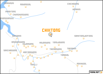
Chik-tong (Chagang, Korea, North)Chik-tong is a town in the Chagang region of Korea, North. An overview map of the region around Chik-tong is displayed below.
regional and 3d topo map of Chik-tong, Korea, North ::
Nearby towns ::
Majŏn-dong (3.4km south west) //
Kanp'o-dong (3.8km south) //
Yŏngjŏ-dong (3.5km south east) //
Chagae-dong (4.5km south) //
Samgŏ-ri (4.5km south west) //
Taesan-dong (5.4km south) //
Paekpan-dong (6.1km south) //
Sosim-dong (6.0km south east) //
Namp'o-dong (5.7km south west) //
Songt'an-dong (6.9km south) //
Horye-ri (5.9km south west) //
Ch'angp'yŏng (7.6km south) //
Chugamdonggu (6.3km south west) //
Sonam-ni (6.9km south east) //
Kwanp'yŏng-ni (8.2km south) //
Yŏrŏ-gol (8.2km south east) //
Taenam-ni (7.5km south east) //
Taesa-dong (8.5km south west) //
Kujŏm-dong (7.3km south west) //
Pakchoktŏgi (8.6km south west) //
Hoeyang-dong (8.7km south west) //
Sang-dong (10.1km south west) //
Hwangch'ŏltŏgi (9.5km south west) //
Sangp'yŏng-ni (10.1km south west) //
[all distances 'as the bird flies' and approximate]  Places with similar names to Chik-tong, Korea, North ::
// Shauktaung (MM)
// Shaukhtaung (MM)
// Shakatanga (CD)
// Chagae-dong (KP)
// Chagae-dong (KP)
// Chagae-dong (KP)
// Chagae-dong (KP)
// Chagaedŭng (KP)
// Chak-tong (KP)
// Chak-tong (KP)
Disclaimer :: Information on this page comes without warranty of any kind |
||
|
Where is Chik-tong? Elevation and coordinates ::
Latitude (lat): 41°31'7"N Longitude (lon): 126°45'5"E
Elevation (approx.): 558m (map arrows pan, magnifying glasses zoom) |
||
|
Visiting Chik-tong? Hotel/Accommodation ::
Book a hotel in Chik-tong Travel Guide ::
rental cars ::
car rental offers GPS waypoint ::
download a GPX waypoint (PoI) of Chik-tong for your GPS receiver
|
||