|
search place name
|
||
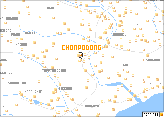
Ch'ŏnp'o-dong (Hamgyŏng, Korea, North)Ch'ŏnp'o-dong is a town in the Hamgyŏng region of Korea, North. An overview map of the region around Ch'ŏnp'o-dong is displayed below.
regional and 3d topo map of Ch'ŏnp'o-dong, Korea, North ::
Nearby towns ::
Ilsil-lodongjagu (0.3km south west) //
Sang-ch'on (0.8km south east) //
Chungbugŭn (0.8km south west) //
Yŏngjŏ-ch'on (0.9km north west) //
Chesam-ch'on (1.1km north east) //
Chongsŏng-dong (1.4km north) //
Ch'op'yŏng (1.3km east) //
Chugan-ch'on (2.1km north) //
Chaeyŏng-dong (2.8km south) //
Sŏdangp'o (3.1km north) //
Chung-ch'on (2.6km north east) //
Tŏksil-li (3.3km north) //
Chung-ch'on (2.9km south east) //
Sang-ch'on (3.2km north east) //
Yongho (3.6km north east) //
Kwirak-ch'on (4.1km north) //
Nambŏl-ch'on (4.3km north) //
Tŏk-ch'on (4.4km north) //
Nongp'yŏng (4.2km south east) //
Kasan-dong (3.5km east) //
K'ŭndojang-dong (3.7km east) //
Yongyŏnp'o (4.2km south east) //
Sang-ch'on (5.1km north) //
Kŭmsŏng-ni (4.4km south east) //
Song-dong (5.2km south) //
Twi-gol (4.3km west) //
Sŭngji (4.6km north east) //
Sogogae (4.4km west) //
Wŏnt'ap (4.4km west) //
[all distances 'as the bird flies' and approximate] 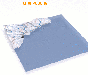 Places with similar names to Ch'ŏnp'o-dong, Korea, North ::
// Chŏnp'o-dong (KP)
// Chinp'i-dong (KP)
Disclaimer :: Information on this page comes without warranty of any kind |
||
|
Where is Ch'ŏnp'o-dong? Elevation and coordinates ::
Latitude (lat): 40°50'47"N Longitude (lon): 129°16'7"E
Elevation (approx.): 47m (map arrows pan, magnifying glasses zoom) |
||
|
Visiting Ch'ŏnp'o-dong? Hotel/Accommodation ::
Book a hotel in Ch'ŏnp'o-dong Travel Guide ::
rental cars ::
car rental offers GPS waypoint ::
download a GPX waypoint (PoI) of Ch'ŏnp'o-dong for your GPS receiver
|
||