|
search place name
|
||
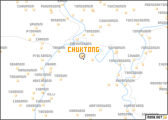
Ch'ŭk-tong (Korea, North)Ch'ŭk-tong is a town in Korea, North. An overview map of the region around Ch'ŭk-tong is displayed below.
regional and 3d topo map of Ch'ŭk-tong, Korea, North ::
Ch'ŭk-tong airports ::
The nearest airport is FNJ - Pyongyang Intl, located 141.8 km south of Ch'ŭk-tong.
Nearby towns ::
Sangch'ang-ni (1.4km east) //
P'yŏngsang-ni (2.3km north east) //
Kuryong-dong (2.3km north west) //
Sinp'ung-dong (2.6km north) //
Naehŭng-dong (2.8km north) //
Tongyŏm-dong (4.8km north) //
Tunjŏn-ni (5.6km north) //
Kamch'am-dong (4.6km north west) //
Tongdo-ri (5.7km north) //
T'aean-ni (4.6km north west) //
Yŏnsu-ri (5.9km south west) //
Sŏkch'ang-ni (5.6km east) //
Sŏksang-ni (5.9km east) //
Kaha-ri (5.9km west) //
Karhŏn-dong (7.0km south east) //
Saji-ri (6.3km south west) //
Yonggŏn-dong (6.2km east) //
Pusŏng-ni (7.9km north) //
Haryanggang-dong (6.7km south east) //
Kangjang-ni (8.8km north) //
Chungnyanggang (7.9km south east) //
Ch'ŭkkang-ni (8.9km north east) //
Ansang-ni (9.0km north west) //
Kil-li (10.2km south west) //
[all distances 'as the bird flies' and approximate] 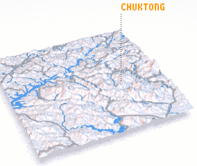 Places with similar names to Ch'ŭk-tong, Korea, North ::
// Shauktaung (MM)
// Shaukhtaung (MM)
// Shakatanga (CD)
// Chagae-dong (KP)
// Chagae-dong (KP)
// Chagae-dong (KP)
// Chagae-dong (KP)
// Chagaedŭng (KP)
// Chak-tong (KP)
// Chak-tong (KP)
Disclaimer :: Information on this page comes without warranty of any kind |
||
|
Where is Ch'ŭk-tong? Elevation and coordinates ::
Latitude (lat): 40°30'0"N Longitude (lon): 125°45'0"E
Elevation (approx.): 232m (map arrows pan, magnifying glasses zoom) |
||
|
Visiting Ch'ŭk-tong? Hotel/Accommodation ::
Book a hotel in Ch'ŭk-tong Travel Guide ::
rental cars ::
car rental offers GPS waypoint ::
download a GPX waypoint (PoI) of Ch'ŭk-tong for your GPS receiver
|
||