|
search place name
|
||
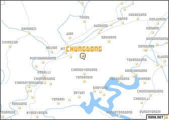
Chung-dong (Chagang, Korea, North)Chung-dong is a town in the Chagang region of Korea, North. An overview map of the region around Chung-dong is displayed below.
regional and 3d topo map of Chung-dong, Korea, North ::
Chung-dong airports ::
The nearest airport is FNJ - Pyongyang Intl, located 211.2 km south of Chung-dong.
Nearby towns ::
Changhyŏn-dong (3.0km south) //
Ha-dong (2.4km west) //
Mit'a-ri (3.5km north west) //
Yŏnsang-ni (4.8km south) //
Ji'an (5.5km north west) //
Sagi-dong (5.8km north east) //
Pyŏro-dong (6.5km north) //
Pŏdŭlbat (7.2km south) //
Maxian (5.8km west) //
Kuo-dong (7.3km north) //
Sinp'yŏng (7.6km south) //
Oryu-ri (8.3km south) //
Tukou (8.6km north) //
Mulbanga-gol (8.4km south east) //
Nonam-ni (7.1km south east) //
Chŏnsanŭm-dong (7.7km south west) //
Yuch'ŏn-dong (7.8km south east) //
Sŏdang-gol (9.2km south) //
Haebang-nodongjagu (9.0km north east) //
Manp'o (10.5km north east) //
[all distances 'as the bird flies' and approximate] 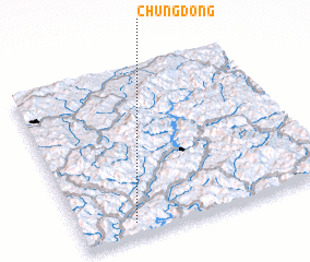 Places with similar names to Chung-dong, Korea, North ::
// Shangdang (MM)
// Chingtang (IN)
// Ch'ang-dong (KP)
// Ch'ang-dong (KP)
// Ch'ang-dong (KP)
// Ch'ang-dong (KP)
// Ch'ang-dong (KP)
// Ch'ang-dong (KP)
// Ch'ang-dong (KP)
// Ch'ang-dong (KP)
Disclaimer :: Information on this page comes without warranty of any kind |
||
|
Where is Chung-dong? Elevation and coordinates ::
Latitude (lat): 41°4'46"N Longitude (lon): 126°12'49"E
Elevation (approx.): 326m (map arrows pan, magnifying glasses zoom) |
||
|
Visiting Chung-dong? Hotel/Accommodation ::
Book a hotel in Chung-dong Travel Guide ::
rental cars ::
car rental offers GPS waypoint ::
download a GPX waypoint (PoI) of Chung-dong for your GPS receiver
|
||