|
search place name
|
||
Hajŏn-dong (Hamgyŏng, Korea, North)Hajŏn-dong is a town in the Hamgyŏng region of Korea, North. An overview map of the region around Hajŏn-dong is displayed below.
regional and 3d topo map of Hajŏn-dong, Korea, North ::
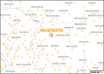
Nearby towns ::
Ingdŏk-tong (1.5km north) //
Nosongdŏk (2.1km west) //
Sŏnbawi (3.1km south west) //
Chobongsani (3.0km east) //
Sa-dong (4.1km south) //
Sa-ri (4.3km north) //
Chŏl-gol (3.9km south west) //
Nŭptŏk (3.7km west) //
Tokchanggae (3.8km north west) //
Kuŏk-tong (4.8km south west) //
Yŏndŏng-ni (4.8km south west) //
Chiramusaegi (4.1km east) //
Ch'anghyŏp (4.7km north west) //
Tokp'o-rodongjagu (4.2km north west) //
Hŭibang-dong (5.3km south) //
Tae-dong (5.3km south west) //
Songp'yŏng (5.8km north) //
Taho-ri (4.7km south west) //
Songhyŏn (4.5km west) //
Chagŭn'gae (4.6km east) //
Ch'ojang-dong (6.0km south) //
Saekkae (4.7km east) //
Hwanggong-ni (5.9km north west) //
Yangyujŏng (4.9km west) //
Naktong-ni (6.4km south) //
Sangnak-tong (6.5km south) //
Sori-dong (5.0km east) //
Yangjŏng-ni (5.1km west) //
Kŏmun-dong (5.3km north west) //
[all distances 'as the bird flies' and approximate] 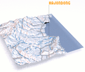 Places with similar names to Hajŏn-dong, Korea, North ::
// Hajŏn-dong (KP)
// Hajunae-dong (KP)
// Hoejŏn-dong (KP)
// Hujin-dong (KP)
// Hoejŏn-dong (KR)
// Hoejŏn-dong (KP)
// Hoejŏn-dong (KP)
Disclaimer :: Information on this page comes without warranty of any kind |
||
|
Where is Hajŏn-dong? Elevation and coordinates ::
Latitude (lat): 41°0'18"N Longitude (lon): 129°28'44"E
Elevation (approx.): 618m (map arrows pan, magnifying glasses zoom) |
||
|
Visiting Hajŏn-dong? Hotel/Accommodation ::
Book a hotel in Hajŏn-dong Travel Guide ::
rental cars ::
car rental offers GPS waypoint ::
download a GPX waypoint (PoI) of Hajŏn-dong for your GPS receiver
|
||