|
search place name
|
||
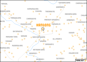
Han-dong (Korea, North)Han-dong is a town in Korea, North. An overview map of the region around Han-dong is displayed below.
regional and 3d topo map of Han-dong, Korea, North ::
Han-dong airports ::
The nearest airport is FNJ - Pyongyang Intl, located 101.0 km south of Han-dong.
Nearby towns ::
Unsan-ŭp (0.5km south) //
Oryu-dong (0.7km west) //
Sŏkpang-dong (1.4km east) //
Sangwŏn-ni (1.4km east) //
Sŏksan-dong (1.4km west) //
Karaenamuwŏn (1.6km south west) //
Chwa-ri (2.3km south west) //
Paksan-dong (3.3km north east) //
Songp'yŏng-dong (2.8km east) //
Yang-dong (3.7km south) //
Pongji-ri (4.0km south) //
Paekhyŏn-dong (4.0km south) //
Sŏkchang-dong (4.0km south) //
To-dong (3.3km west) //
Paengnyong-dong (4.7km north east) //
Chunghŭng-dong (4.3km north west) //
Munam (5.0km south west) //
Ŭmji-dong (4.3km east) //
Ŭm-dong (5.6km south) //
Yŏngung-ni (5.0km north east) //
Tapsang-ni (4.6km north east) //
Masan-dong (4.8km south west) //
Yongnim-dong (6.3km north) //
Chang-dong (5.7km north west) //
P'ungyang-ni (5.6km north west) //
Kudu-ri (5.3km east) //
Yangji-dong (5.7km east) //
Sungch'ung-dong (7.4km south) //
Sang-dong (7.2km south) //
[all distances 'as the bird flies' and approximate] 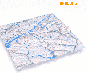 Places with similar names to Han-dong, Korea, North ::
// Handong (PH)
// Hindang (PH)
// Hindang (PH)
// Hindang (PH)
// Hindang (PH)
// Hinding (AT)
// Whenuatonga (NZ)
// Huandunga (PE)
// Hanae-dong (KP)
// Hanae-dong (KP)
Disclaimer :: Information on this page comes without warranty of any kind |
||
|
Where is Han-dong? Elevation and coordinates ::
Latitude (lat): 40°7'0"N Longitude (lon): 125°54'0"E
Elevation (approx.): 122m (map arrows pan, magnifying glasses zoom) |
||
|
Visiting Han-dong? Hotel/Accommodation ::
Book a hotel in Han-dong Travel Guide ::
rental cars ::
car rental offers GPS waypoint ::
download a GPX waypoint (PoI) of Han-dong for your GPS receiver
|
||