|
search place name
|
||
Hoeryŏng (Hamgyŏng, Korea, North)Hoeryŏng is a town in the Hamgyŏng region of Korea, North. An overview map of the region around Hoeryŏng is displayed below.
regional and 3d topo map of Hoeryŏng, Korea, North ::

Nearby towns ::
Mangyang-nodongjagu (1.6km north west) //
Sahak-kol (1.5km north east) //
Tŏkhŭng-ni (2.5km south west) //
Sanhe (3.2km north) //
Hagŭmsaeng-dong (4.2km north) //
Ssukpat (4.1km south west) //
Kŭmsaeng-ni (3.6km east) //
Obong-ni (4.8km south) //
Sŏch'on-dong (4.6km south west) //
Pyŏksŏng-ni (5.8km south west) //
Sŏŭibong (5.3km north east) //
Pongŭimit (6.0km south east) //
Chukp'o-dong (6.2km north east) //
Kungsim-nodongjagu (6.6km north east) //
Yŏngsu-ri (5.7km west) //
Ch'anghyo-ri (5.7km east) //
Nongsak-kol (5.9km east) //
Muk-tong (6.3km east) //
Sunam-dong (7.6km south east) //
Taedŏng-ni (8.8km south east) //
Kach'on (9.9km south east) //
Hongsal-li (10.1km south west) //
[all distances 'as the bird flies' and approximate] 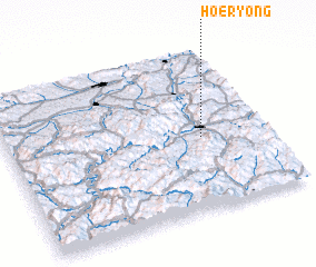 Places with similar names to Hoeryŏng, Korea, North ::
Disclaimer :: Information on this page comes without warranty of any kind |
||
|
Where is Hoeryŏng? Elevation and coordinates ::
Latitude (lat): 42°26'34"N Longitude (lon): 129°45'1"E
Elevation (approx.): 253m (map arrows pan, magnifying glasses zoom) |
||
|
Visiting Hoeryŏng? Hotel/Accommodation ::
Book a hotel in Hoeryŏng Travel Guide ::
rental cars ::
car rental offers GPS waypoint ::
download a GPX waypoint (PoI) of Hoeryŏng for your GPS receiver
|
||