|
search place name
|
||
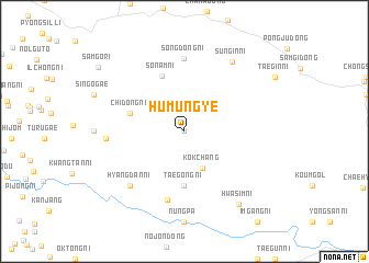
Humun'gye (Korea, North)Humun'gye is a town in Korea, North. An overview map of the region around Humun'gye is displayed below.
regional and 3d topo map of Humun'gye, Korea, North ::
Humun'gye airports ::
The nearest airport is FNJ - Pyongyang Intl, located 69.2 km west of Humun'gye.
Other airports nearby include GMP - Seoul Gimpo (163.3 km south), SSN - Seoul East Seoul Ab (183.0 km south), OSN - Osan Ab (218.7 km south), Nearby towns ::
Munŏ-ri (0.0km north) //
Kokch'ang (4.0km south) //
Taegong-ni (5.6km south) //
Chidong-ni (4.7km north west) //
Sonam-ni (6.0km north) //
Oedae-dong (7.1km south) //
Songdong-ni (7.4km north) //
Hyangdan-ni (7.0km south west) //
Kubin-ni (6.2km west) //
Sungin-ni (8.1km north east) //
Hwasim-ni (8.6km south east) //
Samgo-ri (9.4km north west) //
[all distances 'as the bird flies' and approximate] 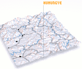 Places with similar names to Humun'gye, Korea, North :: Disclaimer :: Information on this page comes without warranty of any kind |
||
|
Where is Humun'gye? Elevation and coordinates ::
Latitude (lat): 39°0'0"N Longitude (lon): 126°25'0"E
Elevation (approx.): 152m (map arrows pan, magnifying glasses zoom) |
||
|
Visiting Humun'gye? Hotel/Accommodation ::
Book a hotel in Humun'gye Travel Guide ::
rental cars ::
car rental offers GPS waypoint ::
download a GPX waypoint (PoI) of Humun'gye for your GPS receiver
|
||