|
search place name
|
||
Hurgdŏk (Hamgyŏng, Korea, North)Hurgdŏk is a town in the Hamgyŏng region of Korea, North. An overview map of the region around Hurgdŏk is displayed below.
regional and 3d topo map of Hurgdŏk, Korea, North ::

Nearby towns ::
Malgul-li (0.9km east) //
Sanjaedŏk (1.8km south west) //
Hŏt'ong-dong (3.5km east) //
Yŏndae-dong (4.6km north east) //
Hyŏngje-ri (4.2km north east) //
Mari-dong (5.7km north west) //
Sanghyŏn-dong (5.6km south east) //
Ongnyŏn-dong (7.0km south) //
Sinhŭng-dong (6.5km north east) //
P'altam (7.9km north) //
Kujŏng-dong (6.8km south east) //
Kŭmgang-ni (7.0km south east) //
Chŏngt'am-gol (8.2km north) //
Kwangam (6.8km west) //
Changhŭng-dong (8.0km south east) //
Kolbang-gol (8.7km south) //
Changhŭng-dong (8.1km south east) //
Puryŏng-ŭp (9.0km north east) //
Chungp'yŏng-dong (9.2km south east) //
Kuam-dong (9.9km south east) //
Norumogi-gol (10.3km south east) //
Kuam-dong (10.5km south east) //
[all distances 'as the bird flies' and approximate] 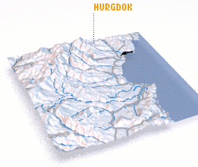 Places with similar names to Hurgdŏk, Korea, North :: Disclaimer :: Information on this page comes without warranty of any kind |
||
|
Where is Hurgdŏk? Elevation and coordinates ::
Latitude (lat): 41°59'35"N Longitude (lon): 129°39'33"E
Elevation (approx.): 342m (map arrows pan, magnifying glasses zoom) |
||
|
Visiting Hurgdŏk? Hotel/Accommodation ::
Book a hotel in Hurgdŏk Travel Guide ::
rental cars ::
car rental offers GPS waypoint ::
download a GPX waypoint (PoI) of Hurgdŏk for your GPS receiver
|
||