|
search place name
|
||
Igabong (Hamgyŏng, Korea, North)Igabong is a town in the Hamgyŏng region of Korea, North. An overview map of the region around Igabong is displayed below.
regional and 3d topo map of Igabong, Korea, North ::

Nearby towns ::
Naejik-tong (0.7km north) //
Changgaedŏk (1.9km south east) //
Kuryong-dong (2.0km west) //
Myŏngdang-dong (2.5km south west) //
Kwanhak-kol (3.5km south east) //
Harip'yŏng (3.5km north west) //
Tŭngdae (3.3km north east) //
Andol-tong (4.7km north) //
Iwŏnji-dong (4.3km south east) //
Sambatkae (4.6km south east) //
Tŭngnŭm-ni (5.5km north) //
Kwŏlp'o (4.4km east) //
Sangi-dong (4.5km west) //
Aresosik-tong (5.7km south) //
Yu-dong (5.6km north west) //
Changp'o-dong (6.0km north) //
Paebŏl (6.2km south) //
Changnim-ni (6.5km north) //
Sagijŏm (5.2km east) //
P'aeŭidŏk (5.7km north east) //
Kari-dong (5.3km east) //
Taehŭngsin-dong (6.1km west) //
Chungp'yŏng-dong (6.3km east) //
Yosan (6.2km east) //
Igadŏgi (7.0km south east) //
Yŏndae-gol (7.1km north east) //
Hoe-dong (8.6km north) //
Sadŏk (6.9km north east) //
Sonamsŏk-tong (8.2km north west) //
[all distances 'as the bird flies' and approximate] 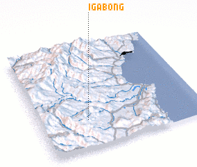
Disclaimer :: Information on this page comes without warranty of any kind |
||
|
Where is Igabong? Elevation and coordinates ::
Latitude (lat): 41°16'39"N Longitude (lon): 129°18'4"E
Elevation (approx.): 1016m (map arrows pan, magnifying glasses zoom) |
||
|
Visiting Igabong? Hotel/Accommodation ::
Book a hotel in Igabong Travel Guide ::
rental cars ::
car rental offers GPS waypoint ::
download a GPX waypoint (PoI) of Igabong for your GPS receiver
|
||