|
search place name
|
||
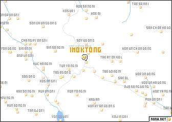
Imok-tong (Korea, North)Imok-tong is a town in Korea, North. An overview map of the region around Imok-tong is displayed below.
regional and 3d topo map of Imok-tong, Korea, North ::
Imok-tong airports ::
The nearest airport is FNJ - Pyongyang Intl, located 117.9 km south of Imok-tong.
Nearby towns ::
Ich'ŏn-ni (0.2km south) //
Tongch'ang-ŭp (1.1km north west) //
Taeyu-nodongjagu (1.7km north) //
Samgŏ-ri (1.9km north) //
Yanghwadŏkch'am (2.2km south) //
Kalmak-tong (2.4km north west) //
Kwangch'ŏn-dong (2.7km south east) //
Soyu-dong (3.7km north) //
Turyong-ni (3.4km south west) //
Kanp'yŏngch'am (3.9km south west) //
Majangch'am (4.7km south east) //
Kajimak-tong (4.7km north east) //
Taebyŏkkol (4.2km east) //
Tada-dong (5.1km south west) //
Taedong-ni (5.3km south east) //
Non-kol (5.6km south west) //
Sinsang-ni (5.5km north west) //
Mokchŏk-kol (5.7km east) //
Kuryong-ni (7.6km south) //
Yaksu-dong (6.6km south east) //
Sakol (7.7km south east) //
Kosŏng-ni (8.2km south west) //
Pongnyong-ni (10.0km south west) //
Puhang-ni (9.9km south west) //
[all distances 'as the bird flies' and approximate]  Places with similar names to Imok-tong, Korea, North ::
Disclaimer :: Information on this page comes without warranty of any kind |
||
|
Where is Imok-tong? Elevation and coordinates ::
Latitude (lat): 40°17'0"N Longitude (lon): 125°34'0"E
Elevation (approx.): 260m (map arrows pan, magnifying glasses zoom) |
||
|
Visiting Imok-tong? Hotel/Accommodation ::
Book a hotel in Imok-tong Travel Guide ::
rental cars ::
car rental offers GPS waypoint ::
download a GPX waypoint (PoI) of Imok-tong for your GPS receiver
|
||