|
search place name
|
||
Iu-ri (Korea, North)Iu-ri is a town in Korea, North. An overview map of the region around Iu-ri is displayed below.
regional and 3d topo map of Iu-ri, Korea, North ::

Iu-ri airports ::
The nearest airport is FNJ - Pyongyang Intl, located 101.8 km south east of Iu-ri.
Nearby towns ::
Masŏng-ni (0.3km east) //
Yŏnbong-ni (0.6km north east) //
An-gol (1.3km south west) //
Tanggol (1.4km east) //
Sambong-dong (1.4km east) //
Sangdan (1.7km south east) //
Ŭngbong-dong (2.3km north east) //
Ippong-dong (2.3km north east) //
Puhwang-ni (2.7km north) //
Wŏlgong-ni (2.3km west) //
Kyosang (2.4km west) //
Nallang-dong (2.9km north west) //
Ŏmsu-gol (2.8km east) //
Chwahyŏn-dong (3.7km north) //
Sinp'o-dong (3.7km north) //
Kwang-dong (3.7km south) //
Sago-dong (3.7km south) //
Kyoha (2.8km west) //
Tongji-ri (3.2km south west) //
Ch'ongsong-ni (3.8km south) //
Hakhyŏndong-Ha-dong (4.0km south) //
Songdang-dong (3.4km north east) //
Noksan-dong (3.4km north east) //
Namsan-dong (4.0km north) //
Songjŏng-dong (4.0km south) //
Ch'ŏn-dong (4.0km south) //
Hadan (4.0km south) //
Kŭnp'yŏng (3.4km south west) //
Chigyŏng (3.4km south west) //
[all distances 'as the bird flies' and approximate] 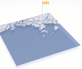 Places with similar names to Iu-ri, Korea, North ::
Disclaimer :: Information on this page comes without warranty of any kind |
||
|
Where is Iu-ri? Elevation and coordinates ::
Latitude (lat): 39°49'0"N Longitude (lon): 124°46'0"E
Elevation (approx.): 71m (map arrows pan, magnifying glasses zoom) |
||
|
Visiting Iu-ri? Hotel/Accommodation ::
Book a hotel in Iu-ri Travel Guide ::
rental cars ::
car rental offers GPS waypoint ::
download a GPX waypoint (PoI) of Iu-ri for your GPS receiver
|
||