|
search place name
|
||
Kaesŏn-dong (Hamgyŏng, Korea, North)Kaesŏn-dong is a town in the Hamgyŏng region of Korea, North. An overview map of the region around Kaesŏn-dong is displayed below.
regional and 3d topo map of Kaesŏn-dong, Korea, North ::

Nearby towns ::
Sutkama-gol (1.5km west) //
Ma-dong (3.9km south) //
Hwangun-dong (6.5km south) //
Samal-tong (6.9km south west) //
Such'ae-dong (8.5km south) //
Tonsan-dong (7.9km north east) //
Ip'a-ri (7.6km south east) //
Yŏngung-dong (8.9km north) //
Unsong-ni (7.9km north east) //
Ch'ang-mal (7.7km south east) //
Hannamun (8.4km north east) //
Ŭnhŭng-ni (9.2km south west) //
Ch'usaengp'yŏng (9.8km south west) //
Songp'a-ch'on (9.7km south east) //
[all distances 'as the bird flies' and approximate] 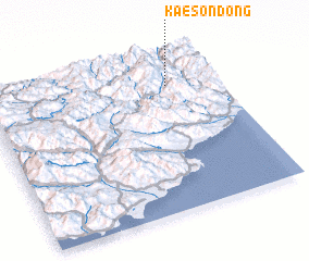 Places with similar names to Kaesŏn-dong, Korea, North ::
// Kaesŏn-dong (KP)
// Kasan-dong (KP)
// Kasan-dong (KP)
// Kasin-dong (KP)
// Koesan-dong (KP)
// Kŏsan-dong (KP)
// Kosan-dong (KP)
// Kosan-dong (KP)
// Kosan-dong (KP)
// Kosan-dong (KP)
Disclaimer :: Information on this page comes without warranty of any kind |
||
|
Where is Kaesŏn-dong? Elevation and coordinates ::
Latitude (lat): 40°48'0"N Longitude (lon): 128°47'0"E
Elevation (approx.): 973m (map arrows pan, magnifying glasses zoom) |
||
|
Visiting Kaesŏn-dong? Hotel/Accommodation ::
Book a hotel in Kaesŏn-dong Travel Guide ::
rental cars ::
car rental offers GPS waypoint ::
download a GPX waypoint (PoI) of Kaesŏn-dong for your GPS receiver
|
||