|
search place name
|
||
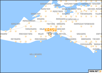
Kamsu (Korea, North)Kamsu is a town in Korea, North. An overview map of the region around Kamsu is displayed below.
regional and 3d topo map of Kamsu, Korea, North ::
Kamsu airports ::
The nearest airport is FNJ - Pyongyang Intl, located 141.4 km north east of Kamsu.
Other airports nearby include GMP - Seoul Gimpo (180.3 km east), Nearby towns ::
Tŏk-tong (0.0km north) //
Kujil-li (0.4km north west) //
Sin'gi (1.5km west) //
Sŏkkyo-dong (2.4km north east) //
Majang-dong (2.4km north west) //
Sŏbyŏng-dong (3.7km north) //
Tŏk-tong (3.7km north) //
Taejin (2.9km east) //
Kalpat-kol (2.9km east) //
Kalbat-kol (2.9km east) //
Majin (2.9km west) //
Yongyŏn-ŭp (3.9km north east) //
Tongbyŏng-dong (4.0km north) //
Hongga-ri (4.0km north) //
Kaebyŏn (3.5km north east) //
Sŏn-ch'on (3.5km north east) //
Paeksa-dong (3.5km south west) //
Hao-dong (4.7km north east) //
Ch'ukhyŏn (4.8km north west) //
Pusan-dong (5.7km north) //
Talguri (6.3km north east) //
Oesan (6.3km north east) //
Pong-dong (6.3km north east) //
An-dong (6.3km north west) //
Paeksu-dong (5.8km east) //
Och'ajil-li (6.0km west) //
Sambong-dong (6.1km east) //
Sinch'on-dong (7.6km north) //
Kŭmdu-dong (6.1km east) //
[all distances 'as the bird flies' and approximate]  Places with similar names to Kamsu, Korea, North ::
Disclaimer :: Information on this page comes without warranty of any kind |
||
|
Where is Kamsu? Elevation and coordinates ::
Latitude (lat): 38°7'0"N Longitude (lon): 124°52'0"E
Elevation (approx.): 6m (map arrows pan, magnifying glasses zoom) |
||
|
Visiting Kamsu? Hotel/Accommodation ::
Book a hotel in Kamsu Travel Guide ::
rental cars ::
car rental offers GPS waypoint ::
download a GPX waypoint (PoI) of Kamsu for your GPS receiver
|
||