|
search place name
|
||
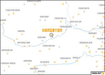
Kangbyŏn (Hamgyŏng, Korea, North)Kangbyŏn is a town in the Hamgyŏng region of Korea, North. An overview map of the region around Kangbyŏn is displayed below.
regional and 3d topo map of Kangbyŏn, Korea, North ::
Kangbyŏn airports ::
The nearest airport is FNJ - Pyongyang Intl, located 122.8 km west of Kangbyŏn.
Other airports nearby include SHO - Sokch'o Sokcho (204.7 km south east), GMP - Seoul Gimpo (219.6 km south), KAG - Kangnung Gangneung (257.2 km south east), Nearby towns ::
Simch'ŏn (3.0km west) //
San'gye (3.7km south east) //
Ch'op'yŏng-ni (4.2km south) //
Yongsang-ni (4.6km north east) //
Yongch'ŏl-li (6.2km north) //
Ch'op'yŏng-ni (5.9km south west) //
Kŭm-ch'on (6.7km north) //
Nŭpsang (7.2km north west) //
Ch'ukchŏl-li (8.7km south) //
Samp'yŏng-ni (7.0km south west) //
Seryu-ch'on (7.9km north east) //
Yongsan-ni (9.2km south east) //
Yongnam-ni (9.2km north east) //
Midul-li (10.7km south east) //
[all distances 'as the bird flies' and approximate] 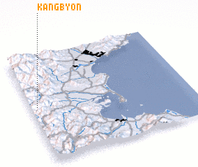 Places with similar names to Kangbyŏn, Korea, North ::
// Kangbyŏn (KP)
// Kangbyŏn (KP)
// Kangbyŏn (KP)
// Kangbyŏn (KR)
// Kangbyŏn-ni (KR)
// Kangbyŏn-ni (KR)
// Gangawbyin (MM)
Disclaimer :: Information on this page comes without warranty of any kind |
||
|
Where is Kangbyŏn? Elevation and coordinates ::
Latitude (lat): 39°31'35"N Longitude (lon): 127°2'28"E
Elevation (approx.): 149m (map arrows pan, magnifying glasses zoom) |
||
|
Visiting Kangbyŏn? Hotel/Accommodation ::
Book a hotel in Kangbyŏn Travel Guide ::
rental cars ::
car rental offers GPS waypoint ::
download a GPX waypoint (PoI) of Kangbyŏn for your GPS receiver
|
||