|
search place name
|
||
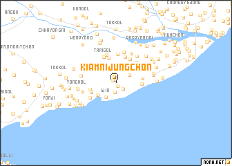
Kiamnijung-ch'on (Hamgyŏng, Korea, North)Kiamnijung-ch'on is a town in the Hamgyŏng region of Korea, North. An overview map of the region around Kiamnijung-ch'on is displayed below.
regional and 3d topo map of Kiamnijung-ch'on, Korea, North ::
Nearby towns ::
Kiam-ni (0.6km south east) //
Kiamnisang-ch'on (0.6km north west) //
Kiamniha-ch'on (1.3km south east) //
Yŏngsujin (1.6km south) //
Wŏn-gol (1.7km north) //
Taerodong-ni (2.1km north east) //
Ijin (2.6km south west) //
Naejin (3.0km south west) //
K'ŭn-gol (4.0km north) //
Chin-ch'on (3.2km east) //
P'yŏng-ch'on (3.4km south west) //
Kokku-ri (3.3km west) //
Komit (3.3km east) //
Kan-gol (4.4km north) //
Suryŏn-dong (4.3km north east) //
Tari-gol (4.4km north) //
Nodong-ni (4.7km north) //
Yonghŭng-ni (4.2km north east) //
Sangmi-gol (4.7km north) //
Hŭngyong-ch'on (4.2km north east) //
Kwansŏ-ri (4.0km south west) //
Yang-ch'on (5.0km north) //
Tŏk-ch'on (4.3km north east) //
Yonggangnijung-ch'on (4.2km north east) //
Yussi-dong (5.2km north) //
Chossi-dong (5.0km north east) //
Yŏngdae (4.4km west) //
Yŏngt'ŏ-gol (4.4km west) //
Yongp'o-ri (4.8km east) //
[all distances 'as the bird flies' and approximate] 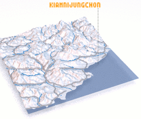 Places with similar names to Kiamnijung-ch'on, Korea, North :: Disclaimer :: Information on this page comes without warranty of any kind |
||
|
Where is Kiamnijung-ch'on? Elevation and coordinates ::
Latitude (lat): 40°22'20"N Longitude (lon): 128°47'43"E
Elevation (approx.): 34m (map arrows pan, magnifying glasses zoom) |
||
|
Visiting Kiamnijung-ch'on? Hotel/Accommodation ::
Book a hotel in Kiamnijung-ch'on Travel Guide ::
rental cars ::
car rental offers GPS waypoint ::
download a GPX waypoint (PoI) of Kiamnijung-ch'on for your GPS receiver
|
||