|
search place name
|
||
Koch'on (P'yŏngyang, Korea, North)Koch'on is a town in the P'yŏngyang region of Korea, North. An overview map of the region around Koch'on is displayed below.
regional and 3d topo map of Koch'on, Korea, North ::

Koch'on airports ::
The nearest airport is FNJ - Pyongyang Intl, located 27.8 km west of Koch'on.
Other airports nearby include GMP - Seoul Gimpo (195.5 km south), SSN - Seoul East Seoul Ab (218.4 km south east), Nearby towns ::
Handae-dong (1.5km north) //
Tong-ni (1.4km south east) //
Hanwang-ni (1.5km north west) //
Yongha-dong (1.4km east) //
Sa-dong (1.9km north) //
Oun-dong (2.2km south) //
Kosan-dong (2.1km south west) //
Kyŏngsil-li (2.2km north west) //
Kŭmp'o-dong (2.4km south) //
Kŭmgong-ni (2.3km north east) //
Obae (2.6km north west) //
Chŏndang-gol (3.0km north east) //
Kŭmch'on (2.7km south west) //
Songu-dong (2.8km north west) //
Sil-li (2.8km east) //
Ch'ayŏn-dong (3.1km north east) //
Hyangmong-ni (2.8km east) //
Kkok-kol (3.8km south) //
Am-mal (3.1km east) //
Hu-dong (3.6km north east) //
Pongam-dong (3.2km west) //
Kyegyo-dong (4.2km north) //
T'ongdu-dong (3.8km north west) //
Nae-dong (4.0km south east) //
Munp'yŏng-ni (4.0km south east) //
Sŏch'ang-gol (3.5km west) //
Tongsam-ni (3.9km south east) //
Hyanggyo-ri (4.5km south) //
Chungp'yŏng (4.3km south west) //
[all distances 'as the bird flies' and approximate] 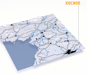 Places with similar names to Koch'on, Korea, North ::
Disclaimer :: Information on this page comes without warranty of any kind |
||
|
Where is Koch'on? Elevation and coordinates ::
Latitude (lat): 39°12'12"N Longitude (lon): 125°59'28"E
Elevation (approx.): 47m (map arrows pan, magnifying glasses zoom) |
||
|
Visiting Koch'on? Hotel/Accommodation ::
Book a hotel in Koch'on Travel Guide ::
rental cars ::
car rental offers GPS waypoint ::
download a GPX waypoint (PoI) of Koch'on for your GPS receiver
|
||