|
search place name
|
||
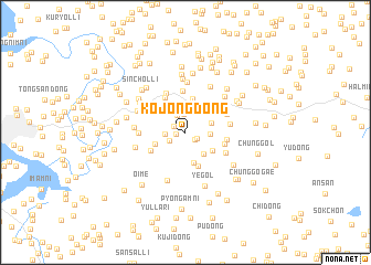
Kojŏng-dong (Hwanghae, Korea, North)Kojŏng-dong is a town in the Hwanghae region of Korea, North. An overview map of the region around Kojŏng-dong is displayed below.
regional and 3d topo map of Kojŏng-dong, Korea, North ::
Kojŏng-dong airports ::
The nearest airport is GMP - Seoul Gimpo, located 107.4 km south east of Kojŏng-dong.
Other airports nearby include FNJ - Pyongyang Intl (112.5 km north), SSN - Seoul East Seoul Ab (137.1 km south east), OSN - Osan Ab (160.4 km south east), Nearby towns ::
Chungdap-tong (0.7km west) //
Panggu-dong (1.1km south east) //
Sinch'on-dong (1.1km south east) //
So-dong (1.1km north west) //
Sangdap-tong (1.5km south west) //
Chinch'ŏl-li (1.9km north) //
Hanon-gol (1.8km north) //
Sae-gol (1.6km west) //
Chinsŏng-ni (1.9km east) //
Chatchae (2.5km north) //
Taemi-ri (2.3km north east) //
T'oong-ni (2.6km south east) //
Suwŏn-ni (3.2km south) //
Kach'i-dong (2.8km south east) //
Suwŏl-li (2.7km south west) //
Sahangch'on (3.4km north) //
Paengnak-tong (3.5km south) //
Kunyu-dong (3.3km south west) //
Paek-ch'on (3.5km north east) //
Chorongch'on (3.9km north west) //
Se-gol (3.3km east) //
Hagamt'o-dong (3.4km east) //
Hasin-dong (4.2km north) //
Ch'ŏngsŏktu-ri (4.2km north) //
Oryujŏng (3.9km north east) //
Sanggamt'o-dong (3.8km south east) //
Kombau-gol (3.8km north east) //
Sanggombau-gol (3.7km east) //
Pongsu-dong (3.9km north west) //
[all distances 'as the bird flies' and approximate]  Places with similar names to Kojŏng-dong, Korea, North ::
// Kaejŏng-dong (KP)
// Kaejong-dong (KP)
// Kajang-dong (KP)
// Kajang-dong (KP)
// Kajang-dong (KP)
// Kajang-dong (KP)
// Kajang-dong (KP)
// Kajŏng-dong (KP)
// Kajŏng-dong (KP)
// Kajŏng-dong (KP)
Disclaimer :: Information on this page comes without warranty of any kind |
||
|
Where is Kojŏng-dong? Elevation and coordinates ::
Latitude (lat): 38°13'41"N Longitude (lon): 125°54'32"E
Elevation (approx.): 97m (map arrows pan, magnifying glasses zoom) |
||
|
Visiting Kojŏng-dong? Hotel/Accommodation ::
Book a hotel in Kojŏng-dong Travel Guide ::
rental cars ::
car rental offers GPS waypoint ::
download a GPX waypoint (PoI) of Kojŏng-dong for your GPS receiver
|
||