|
search place name
|
||
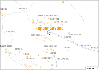
K'ŭndŭngnyŏng (Yanggang, Korea, North)K'ŭndŭngnyŏng is a town in the Yanggang region of Korea, North. An overview map of the region around K'ŭndŭngnyŏng is displayed below.
regional and 3d topo map of K'ŭndŭngnyŏng, Korea, North ::
Nearby towns ::
Chagŭndŭngnyŏng (1.3km north) //
Pajasan (1.5km south west) //
Hapsu (1.9km north) //
Sangdŏgi (1.6km west) //
Sangch'op'yŏng (2.1km south) //
Namsŏk (2.3km north) //
Sinhŭng-dong (1.9km south west) //
Tohŭng-dong (2.7km south west) //
Sinyangp'yŏng (2.4km east) //
Hanamgye (3.1km north west) //
Sŏryŏng (3.7km north) //
Yanghŭng-nodongjagu (3.2km north west) //
Sangnamgye (3.5km north west) //
Namsan (4.3km north) //
Ssukpattŏgi (4.5km north) //
Ant'aek (4.8km north) //
Tohwa-dong (3.8km west) //
Puk-ch'on (4.8km north) //
Nam-ch'on (4.6km north west) //
Haksŏl-li (5.3km south) //
Pukkyesu (5.2km north) //
Taehŭng-dong (5.5km south) //
Kanji-dong (5.9km south) //
Wŏn-dong (5.6km north west) //
Nŏltari-gol (5.3km north east) //
Taet'aeng-nodongjagu (6.3km north) //
Chŏngmokkogae (6.6km south) //
Kwant'ŏ (6.0km north west) //
Sŭngjidŏk (6.6km south) //
[all distances 'as the bird flies' and approximate]  Places with similar names to K'ŭndŭngnyŏng, Korea, North :: Disclaimer :: Information on this page comes without warranty of any kind |
||
|
Where is K'ŭndŭngnyŏng? Elevation and coordinates ::
Latitude (lat): 41°12'8"N Longitude (lon): 128°51'17"E
Elevation (approx.): 1352m (map arrows pan, magnifying glasses zoom) |
||
|
Visiting K'ŭndŭngnyŏng? Hotel/Accommodation ::
Book a hotel in K'ŭndŭngnyŏng Travel Guide ::
rental cars ::
car rental offers GPS waypoint ::
download a GPX waypoint (PoI) of K'ŭndŭngnyŏng for your GPS receiver
|
||