|
search place name
|
||
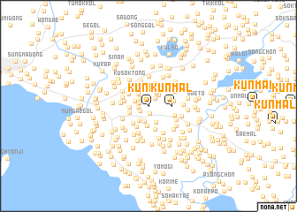
K'ŭnmal (Hwanghae, Korea, North)K'ŭnmal is a town in the Hwanghae region of Korea, North. An overview map of the region around K'ŭnmal is displayed below.
regional and 3d topo map of K'ŭnmal, Korea, North ::
K'ŭnmal airports ::
The nearest airport is GMP - Seoul Gimpo, located 92.5 km south east of K'ŭnmal.
Other airports nearby include SSN - Seoul East Seoul Ab (123.5 km south east), FNJ - Pyongyang Intl (138.2 km north), OSN - Osan Ab (141.7 km south east), Nearby towns ::
Togo-dong (1.0km south) //
Pach'ŏngmŏri (1.0km north west) //
Changwŏlmae (1.0km south west) //
Kak-kol (1.0km west) //
Ch'ŏngnyong-dong (1.2km north east) //
Ch'ŏgyang-gol (1.0km west) //
Yangŏ-dong (1.3km north west) //
Sinmok-tong (1.3km north west) //
Kol-ch'on (1.7km north east) //
Anch'ŏngmŏri (1.5km north west) //
Sae-gol (1.7km north east) //
Ch'ŏktu-ri (1.8km north west) //
Chonghwaul (2.0km south) //
Hwasal-li (2.1km south west) //
Namsaet'ŏ (2.2km south) //
Ch'ŏngnyong-dong (2.3km north) //
Iam (2.4km north) //
Hŭgŏ-gol (1.9km west) //
Taesal-li (2.5km south) //
Man'gajang (2.1km south west) //
Kan-ch'on (2.3km north east) //
Pam-dong (2.3km north east) //
Hu-dong (2.3km north east) //
Yangŏ-dong (2.5km north west) //
Sinmok-tong (2.6km north west) //
Su-gol (2.7km south west) //
Pongnae (2.9km north) //
K'ŭnmal (2.3km east) //
Ussŏng-gol (2.9km south west) //
[all distances 'as the bird flies' and approximate] 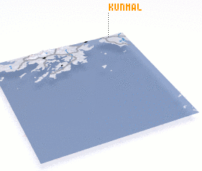 Places with similar names to K'ŭnmal, Korea, North ::
Disclaimer :: Information on this page comes without warranty of any kind |
||
|
Where is K'ŭnmal? Elevation and coordinates ::
Latitude (lat): 37°59'28"N Longitude (lon): 125°53'34"E
Elevation (approx.): 14m (map arrows pan, magnifying glasses zoom) |
||
|
Visiting K'ŭnmal? Hotel/Accommodation ::
Book a hotel in K'ŭnmal Travel Guide ::
rental cars ::
car rental offers GPS waypoint ::
download a GPX waypoint (PoI) of K'ŭnmal for your GPS receiver
|
||