|
search place name
|
||
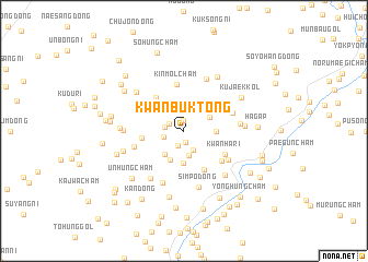
Kwanbuk-tong (P'yŏngan, Korea, North)Kwanbuk-tong is a town in the P'yŏngan region of Korea, North. An overview map of the region around Kwanbuk-tong is displayed below.
regional and 3d topo map of Kwanbuk-tong, Korea, North ::
Kwanbuk-tong airports ::
The nearest airport is FNJ - Pyongyang Intl, located 102.0 km south of Kwanbuk-tong.
Nearby towns ::
Yangji-dong (1.1km north) //
Chungp'yŏng-dong (1.2km south) //
T'aep'yŏng-ni (1.5km south) //
Sinhwa-ri (1.4km north west) //
Yongyŏn-dong (1.5km west) //
Sinhŭng-dong (1.7km west) //
Kwansang-dong (2.1km south) //
Tongbu-dong (2.6km south) //
P'ungdŏkch'am (2.4km north east) //
Yŏnhŭng-dong (2.8km south west) //
Yŏngdaech'am (2.5km east) //
P'ungjŏn-dong (3.1km south) //
Songgotchi-dong (2.8km north east) //
Yonghŭng-dong (3.3km south) //
Chosan-dong (3.1km north west) //
Hyanggyo-dong (3.4km west) //
Haya-dong (4.0km north west) //
Kamdang-dong (4.2km south) //
Kinmolch'am (4.7km north) //
Kwanha-ri (4.0km south east) //
Taejŏn (4.3km south east) //
Ŏŭn-gol (4.2km north east) //
Chŏnp'yŏng (4.6km south east) //
Hasŏ-ri (4.3km south west) //
Ihyŏnch'am (5.6km south) //
Sangsŏ-ri (5.6km north) //
Songji-ri (4.5km east) //
Simp'o-dong (5.9km south) //
Yonghŭng-ni (5.5km south west) //
[all distances 'as the bird flies' and approximate] 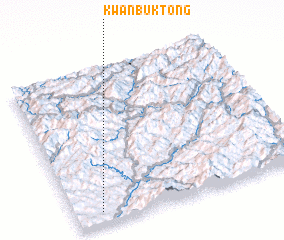 Places with similar names to Kwanbuk-tong, Korea, North ::
// Kwanbuk-tong (KP)
Disclaimer :: Information on this page comes without warranty of any kind |
||
|
Where is Kwanbuk-tong? Elevation and coordinates ::
Latitude (lat): 40°4'35"N Longitude (lon): 126°6'48"E
Elevation (approx.): 171m (map arrows pan, magnifying glasses zoom) |
||
|
Visiting Kwanbuk-tong? Hotel/Accommodation ::
Book a hotel in Kwanbuk-tong Travel Guide ::
rental cars ::
car rental offers GPS waypoint ::
download a GPX waypoint (PoI) of Kwanbuk-tong for your GPS receiver
|
||