|
search place name
|
||
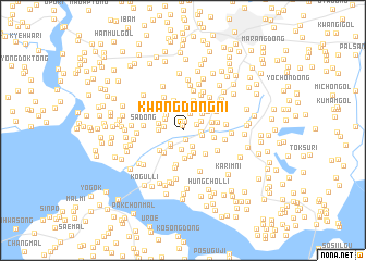
Kwangdŏng-ni (Kaesŏng, Korea, North)Kwangdŏng-ni is a town in the Kaesŏng region of Korea, North. An overview map of the region around Kwangdŏng-ni is displayed below.
regional and 3d topo map of Kwangdŏng-ni, Korea, North ::
Kwangdŏng-ni airports ::
The nearest airport is GMP - Seoul Gimpo, located 43.6 km south east of Kwangdŏng-ni.
Other airports nearby include SSN - Seoul East Seoul Ab (72.0 km south east), OSN - Osan Ab (99.1 km south east), FNJ - Pyongyang Intl (166.1 km north west), YEC - Yechon Yecheon (214.6 km south east), Nearby towns ::
Tumun-dong (0.5km north) //
Sinsŏng-ni (1.0km south) //
Yongmunsa-dong (1.0km north) //
Handari (1.3km north east) //
Sinjung-ni (1.4km east) //
Sogwido-ri (1.7km south west) //
Hongch'on-dong (1.8km north) //
Sinhyŏn (1.8km south east) //
K'ŭn-mal (2.0km south) //
Kwangsu-ri (1.6km west) //
Yul-tong (1.6km east) //
Kan-dong (1.7km north east) //
Kwido-ri (2.0km south west) //
Naengjŏng-dong (1.9km north west) //
Chungnyŏl-li (2.1km north west) //
Yunch'on-dong (2.4km north) //
Muksong-ni (2.4km north) //
Kuŭm-ni (2.4km south) //
Hogun-dong (2.0km west) //
Kung-gol (2.3km north east) //
Ojŏn-dong (2.1km west) //
Mokchŏsŏng (2.7km south) //
Sŏjŏng (2.8km south) //
Kosan-dong (2.4km east) //
Towŏl-li (2.8km south west) //
Nŏmjŏl-gol (2.5km east) //
Paekch'on-dong (2.8km north east) //
P'ungdŏng-ni (2.8km south west) //
Kosan-dong (3.2km north) //
[all distances 'as the bird flies' and approximate] 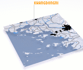 Places with similar names to Kwangdŏng-ni, Korea, North ::
// Kwangdŏng-ni (KP)
// Kwangdŏng-ni (KP)
// Kwangdŏng-ni (KP)
// Kwangdong-ni (KP)
// Kwangdong-ni (KP)
// Kwangdong-ni (KP)
// Kwangdong-ni (KP)
// Kwangt'ong-ni (KP)
// Kwangdŏng-ni (KR)
// Kwangdŏng-ni (KR)
Disclaimer :: Information on this page comes without warranty of any kind |
||
|
Where is Kwangdŏng-ni? Elevation and coordinates ::
Latitude (lat): 37°52'49"N Longitude (lon): 126°30'26"E
Elevation (approx.): 14m (map arrows pan, magnifying glasses zoom) |
||
|
Visiting Kwangdŏng-ni? Hotel/Accommodation ::
Book a hotel in Kwangdŏng-ni Travel Guide ::
rental cars ::
car rental offers GPS waypoint ::
download a GPX waypoint (PoI) of Kwangdŏng-ni for your GPS receiver
|
||