|
search place name
|
||
Kyŏngsang-ni (P'yŏngan, Korea, North)Kyŏngsang-ni is a town in the P'yŏngan region of Korea, North. An overview map of the region around Kyŏngsang-ni is displayed below.
regional and 3d topo map of Kyŏngsang-ni, Korea, North ::

Kyŏngsang-ni airports ::
The nearest airport is FNJ - Pyongyang Intl, located 83.1 km south of Kyŏngsang-ni.
Nearby towns ::
P'ihyŏl-li (1.9km north) //
Map'yŏng-ni (1.7km north west) //
Yongp'o-ri (2.0km south west) //
Songt'ae-ri (2.3km south west) //
Anp'yŏng-ni (2.6km south east) //
Pongjŏl-li (2.4km east) //
Ant'ae-ri (3.1km south west) //
Anhŭng-ni (3.1km south west) //
Majang-dong (3.0km north west) //
T'aech'ŏn-ŭp (3.6km south) //
Kwangp'yŏng-ni (4.6km south) //
Kwallyong-dong (4.6km south) //
Namsan (4.6km south) //
Namp'yŏng (4.6km south) //
Tangjŏ-ri (4.6km south) //
Kwanp'ung-ni (4.6km south) //
Pokhyŏl-li (4.0km south west) //
Ŭndŏng-ni (4.0km north west) //
Imgye-ri (4.6km north) //
Pongch'ŏn-dong (4.6km north) //
Sinbong-ni (4.8km south) //
Kwangam-ni (4.0km south west) //
P'osang-ni (4.8km south) //
Hŭngp'yŏng-ni (5.4km south) //
Pup'yŏng-ni (4.6km south west) //
Ponghu-ri (4.4km west) //
Yonghŭng-ni (5.4km south west) //
P'ungsŏng-ni (5.1km south west) //
Sindŏng-ni (4.9km west) //
[all distances 'as the bird flies' and approximate] 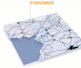 Places with similar names to Kyŏngsang-ni, Korea, North ::
// Kyŏngsang-ni (KP)
Disclaimer :: Information on this page comes without warranty of any kind |
||
|
Where is Kyŏngsang-ni? Elevation and coordinates ::
Latitude (lat): 39°57'30"N Longitude (lon): 125°29'0"E
Elevation (approx.): 124m (map arrows pan, magnifying glasses zoom) |
||
|
Visiting Kyŏngsang-ni? Hotel/Accommodation ::
Book a hotel in Kyŏngsang-ni Travel Guide ::
rental cars ::
car rental offers GPS waypoint ::
download a GPX waypoint (PoI) of Kyŏngsang-ni for your GPS receiver
|
||