|
search place name
|
||
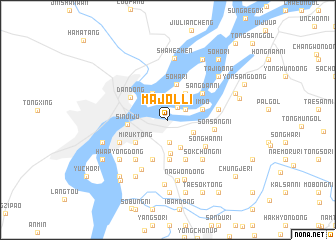
Majŏl-li (Korea, North)Majŏl-li is a town in Korea, North. An overview map of the region around Majŏl-li is displayed below.
regional and 3d topo map of Majŏl-li, Korea, North ::
Majŏl-li airports ::
The nearest airport is FNJ - Pyongyang Intl, located 144.5 km south east of Majŏl-li.
Nearby towns ::
Sindo-dong (1.6km north east) //
Chŏngmun-ni (1.9km north east) //
P'ungha-dong (2.6km south) //
Sŏnha-dong (2.6km south east) //
T'apchung-dong (3.2km south) //
Hadan-ni (3.3km north west) //
Tongha-ri (3.4km north east) //
Sŏkha-ri (3.7km south) //
Ch'ŏn'gajang (3.1km east) //
Imdo (3.1km east) //
Sŏha-ri (4.1km north) //
Minp'o-dong (3.8km south west) //
Mirŭk-tong (3.8km south west) //
Kwangsŏng-ŭp (4.4km south) //
Sinp'ung-ni (4.4km south) //
Sinŭiju (3.5km west) //
Yŏndae-dong (4.6km south) //
Wai-dong (4.6km south) //
Paekt'o-ri (4.6km south) //
P'ungsŏ-dong (4.6km south) //
Yu-dong (4.7km south) //
Sangdan-ni (4.2km north east) //
Dandong (4.1km north west) //
Songhan-ni (4.4km south east) //
Sŏnsang-ni (4.1km east) //
Nammin-ni (5.2km south west) //
Sumun-dong (5.2km south west) //
Chŏngju-dong (4.5km east) //
Sŏkchung-ni (5.3km south east) //
[all distances 'as the bird flies' and approximate] 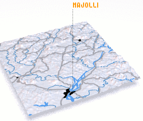 Places with similar names to Majŏl-li, Korea, North ::
Disclaimer :: Information on this page comes without warranty of any kind |
||
|
Where is Majŏl-li? Elevation and coordinates ::
Latitude (lat): 40°6'23"N Longitude (lon): 124°25'56"E
Elevation (approx.): 9m (map arrows pan, magnifying glasses zoom) |
||
|
Visiting Majŏl-li? Hotel/Accommodation ::
Book a hotel in Majŏl-li Travel Guide ::
rental cars ::
car rental offers GPS waypoint ::
download a GPX waypoint (PoI) of Majŏl-li for your GPS receiver
|
||