|
search place name
|
||
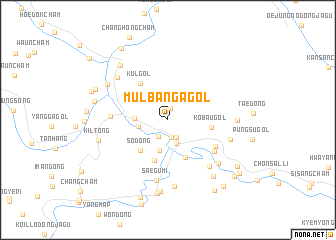
Mulbanga-gol (Chagang, Korea, North)Mulbanga-gol is a town in the Chagang region of Korea, North. An overview map of the region around Mulbanga-gol is displayed below.
regional and 3d topo map of Mulbanga-gol, Korea, North ::
Mulbanga-gol airports ::
The nearest airport is FNJ - Pyongyang Intl, located 170.0 km south west of Mulbanga-gol.
Nearby towns ::
Pangnak-kol (1.3km north) //
Sŏndol (2.0km south) //
Unsong-nodongjagu (2.0km south) //
Sŏksŏngch'am (2.0km south west) //
Toragi (2.7km south) //
Chŏnch'ŏn-ŭp (2.6km west) //
Ch'angp'yŏng (3.5km south) //
Chunghuŭngch'am (2.8km west) //
So-dong (4.1km south west) //
Soksach'am (4.5km south) //
Kkach'i-gol (4.7km south) //
Kobau-gol (3.8km east) //
Kul-gol (4.7km north west) //
Tumul-li (5.0km south east) //
Magŏri (5.3km south east) //
Masŏn-gol (4.9km west) //
Saegumi (6.8km south) //
Changjae-gol (6.3km south east) //
Yongsŏngch'am (5.7km east) //
Ch'iksan (6.4km north west) //
Ubong-gol (7.4km south) //
Kyebangp'yŏng (6.5km south east) //
Chŏl-gol (5.9km east) //
Hwaamch'am (6.5km north west) //
Ch'angp'yŏng-ni (8.0km south) //
Hwaam-nodongjagu (7.3km north west) //
Songjŏng-gol (7.4km south east) //
Kil-tong (6.3km west) //
Sin'gwangjin (8.3km south) //
[all distances 'as the bird flies' and approximate] 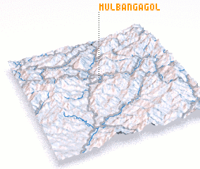 Places with similar names to Mulbanga-gol, Korea, North ::
Disclaimer :: Information on this page comes without warranty of any kind |
||
|
Where is Mulbanga-gol? Elevation and coordinates ::
Latitude (lat): 40°36'50"N Longitude (lon): 126°30'20"E
Elevation (approx.): 559m (map arrows pan, magnifying glasses zoom) |
||
|
Visiting Mulbanga-gol? Hotel/Accommodation ::
Book a hotel in Mulbanga-gol Travel Guide ::
rental cars ::
car rental offers GPS waypoint ::
download a GPX waypoint (PoI) of Mulbanga-gol for your GPS receiver
|
||