|
search place name
|
||
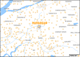
Mundŏg-ŭp (P'yŏngan, Korea, North)Mundŏg-ŭp is a town in the P'yŏngan region of Korea, North. An overview map of the region around Mundŏg-ŭp is displayed below.
regional and 3d topo map of Mundŏg-ŭp, Korea, North ::
Mundŏg-ŭp airports ::
The nearest airport is FNJ - Pyongyang Intl, located 30.9 km south of Mundŏg-ŭp.
Other airports nearby include GMP - Seoul Gimpo (239.1 km south east), Nearby towns ::
Sangbuktong-ni (1.1km north) //
Yudŏk-kol (1.1km west) //
Hyŏphŭng-ni (1.5km south) //
Mansŏng-ni (1.6km south west) //
Ŏryong-ni (2.1km south east) //
Yongam-ni (2.3km north) //
T'ogyo-ri (1.8km east) //
Ponghang-ni (2.3km north east) //
Unam-ni (2.5km north west) //
Unch'ŏl-li (2.2km west) //
Tŭngnyong-ni (2.9km south) //
Yakch'ŏl-li (2.4km west) //
Maebong-ni (3.6km north) //
Paekhang-ni (3.7km south) //
Yongdam-ni (3.3km north west) //
Yonggong-ni (3.3km north west) //
Sinch'ŏl-li (3.7km south) //
Soni-ri (3.9km south) //
Torhak-kogae (3.1km east) //
Tŭngnyong-ni (3.6km south east) //
Yongho-ri (3.3km north west) //
Samsan-ni (4.1km north) //
Yongp'o-ri (3.9km south east) //
Changbaeng-ni (4.2km north) //
Yangch'ŏl-li (3.3km east) //
Namdong-ni (3.3km west) //
Yongsang-ni (3.3km east) //
Masan-ni (4.2km north) //
Kuam-ni (4.2km north) //
[all distances 'as the bird flies' and approximate]  Places with similar names to Mundŏg-ŭp, Korea, North ::
// Manada Gap (US)
Disclaimer :: Information on this page comes without warranty of any kind |
||
|
Where is Mundŏg-ŭp? Elevation and coordinates ::
Latitude (lat): 39°29'47"N Longitude (lon): 125°35'42"E
Elevation (approx.): 26m (map arrows pan, magnifying glasses zoom) |
||
|
Visiting Mundŏg-ŭp? Hotel/Accommodation ::
Book a hotel in Mundŏg-ŭp Travel Guide ::
rental cars ::
car rental offers GPS waypoint ::
download a GPX waypoint (PoI) of Mundŏg-ŭp for your GPS receiver
|
||