|
search place name
|
||
Namp'yŏng-ni (Yanggang, Korea, North)Namp'yŏng-ni is a town in the Yanggang region of Korea, North. An overview map of the region around Namp'yŏng-ni is displayed below.
regional and 3d topo map of Namp'yŏng-ni, Korea, North ::
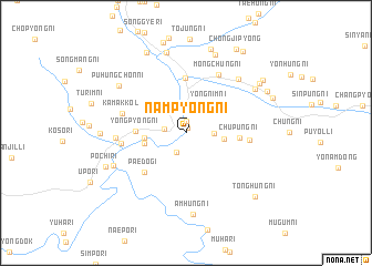
Nearby towns ::
Ŏngnyŏl-li (0.5km north) //
Changp'yŏng-ni (1.2km north) //
T'ongnam-gol (2.1km south) //
Sap'yŏng-ni (1.7km west) //
Sadonggu-ri (2.8km north) //
Chungp'yŏng-ni (2.2km east) //
Yongnim-ni (3.4km north east) //
Ssangso-ri (3.0km east) //
Imdong-ni (3.2km west) //
Tongch'ŏl-li (3.3km west) //
Yongp'yŏng-ni (3.8km west) //
Ch'up'ung-ni (4.1km east) //
Kapsan-ŭp (5.5km north) //
Paedŏgi (5.1km south west) //
Ssangdae-ri (4.9km east) //
Hagarim (5.0km west) //
Kamak-kol (5.2km west) //
Mongch'ung-ni (6.4km north east) //
Koŏgu (5.3km west) //
Chigyŏng-ni (6.8km north east) //
Karim-ni (6.4km south west) //
Puhŭngch'on-ni (6.9km north west) //
Amhŭng-ni (8.3km south) //
Nop'yŏng-ni (6.9km north east) //
Koam-ni (8.2km north) //
Sedong-ni (8.2km north) //
Kohwa-ri (6.5km west) //
P'och'i-ri (7.0km south west) //
Tohoe-dong (8.6km north) //
[all distances 'as the bird flies' and approximate] 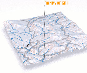 Places with similar names to Namp'yŏng-ni, Korea, North ::
// Namp'yŏng-ni (KP)
// Namp'yŏng-ni (KP)
Disclaimer :: Information on this page comes without warranty of any kind |
||
|
Where is Namp'yŏng-ni? Elevation and coordinates ::
Latitude (lat): 41°2'27"N Longitude (lon): 128°17'38"E
Elevation (approx.): 824m (map arrows pan, magnifying glasses zoom) |
||
|
Visiting Namp'yŏng-ni? Hotel/Accommodation ::
Book a hotel in Namp'yŏng-ni Travel Guide ::
rental cars ::
car rental offers GPS waypoint ::
download a GPX waypoint (PoI) of Namp'yŏng-ni for your GPS receiver
|
||