|
search place name
|
||
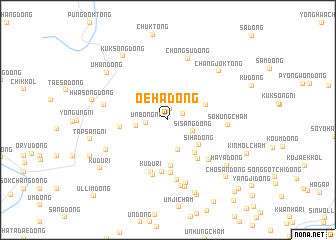
Oeha-dong (P'yŏngan, Korea, North)Oeha-dong is a town in the P'yŏngan region of Korea, North. An overview map of the region around Oeha-dong is displayed below.
regional and 3d topo map of Oeha-dong, Korea, North ::
Oeha-dong airports ::
The nearest airport is FNJ - Pyongyang Intl, located 107.6 km south of Oeha-dong.
Nearby towns ::
Naejung-dong (1.3km north) //
Naeha-dong (1.4km north east) //
Unbong-ni (1.9km west) //
Sisang-dong (2.5km south east) //
Naesang-dong (2.8km north west) //
Ch'anggye-dong (3.4km south) //
Oesang-dong (2.8km west) //
Siha-dong (3.9km south east) //
Ch'ujŏn-dong (3.7km north east) //
Sagi-dong (4.4km south east) //
Naengjŏngch'am (5.1km south) //
Hwamok-tong (4.2km west) //
Chosal-li (5.1km south east) //
Ŭnhach'am (5.8km south) //
Naengjŏng-dong (5.9km south) //
Kudu-ri (6.0km south) //
Unbongch'am (6.3km south) //
Yasang-dong (5.7km south east) //
Sŏhŭngch'am (5.2km east) //
Kududongch'uk-tong (6.8km south) //
Chŏngsu-dong (7.1km north) //
Kandongch'am (7.2km south) //
Taesŏng-dong (5.7km west) //
Sangsŏ-ri (7.5km south) //
Yangji-dong (6.2km south west) //
Tae-dong (7.7km south) //
Changjok-tong (7.0km north east) //
Haya-dong (7.2km south east) //
Uhan-dong (7.4km north west) //
[all distances 'as the bird flies' and approximate]  Places with similar names to Oeha-dong, Korea, North ::
Disclaimer :: Information on this page comes without warranty of any kind |
||
|
Where is Oeha-dong? Elevation and coordinates ::
Latitude (lat): 40°9'9"N Longitude (lon): 126°1'42"E
Elevation (approx.): 283m (map arrows pan, magnifying glasses zoom) |
||
|
Visiting Oeha-dong? Hotel/Accommodation ::
Book a hotel in Oeha-dong Travel Guide ::
rental cars ::
car rental offers GPS waypoint ::
download a GPX waypoint (PoI) of Oeha-dong for your GPS receiver
|
||