|
search place name
|
||
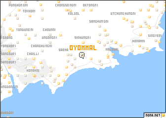
Ŏyŏm-mal (Korea, North)Ŏyŏm-mal is a town in Korea, North. An overview map of the region around Ŏyŏm-mal is displayed below.
regional and 3d topo map of Ŏyŏm-mal, Korea, North ::
Ŏyŏm-mal airports ::
The nearest airport is SHO - Sokch'o Sokcho, located 206.1 km south of Ŏyŏm-mal.
Nearby towns ::
Pathŏri (1.4km east) //
Tongdo-ri (1.4km west) //
Nongyang-ni (2.3km south west) //
Majŏl-li (2.4km south west) //
Sinsang-ni (2.3km north west) //
Sinsŏng-ni (2.7km west) //
Saemaul-li (2.8km west) //
Onggi-dong (3.7km north) //
Sinhŭng-ni (3.7km north) //
Sŏjung-ni (2.9km east) //
Samgŏri (3.4km south west) //
Sŏdo-ri (3.4km south west) //
Sŏhŭng-ni (3.4km south west) //
Pŏlgye (3.5km east) //
Undong-ni (4.6km south west) //
Sŏngdong-ni (4.7km north east) //
Changhŭng-ni (4.8km north east) //
Wŏnsang-ni (4.3km east) //
Yŏho-ri (4.4km east) //
Hŭngsŏ-ri (4.9km north east) //
Chunghŭng-dong (6.0km south west) //
Kyŏnghŭng-ni (5.7km north east) //
Sanggong-ni (6.2km north east) //
Sinp'ung-ni (5.7km north east) //
Hŭngsang-ni (5.7km south west) //
Malgumi (5.3km east) //
Sadong-ni (6.7km north east) //
Tonghŭng-dong (6.7km north west) //
Hunong-ni (6.0km west) //
[all distances 'as the bird flies' and approximate] 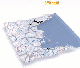 Places with similar names to Ŏyŏm-mal, Korea, North :: Disclaimer :: Information on this page comes without warranty of any kind |
||
|
Where is Ŏyŏm-mal? Elevation and coordinates ::
Latitude (lat): 39°52'0"N Longitude (lon): 127°43'0"E
Elevation (approx.): 16m (map arrows pan, magnifying glasses zoom) |
||
|
Visiting Ŏyŏm-mal? Hotel/Accommodation ::
Book a hotel in Ŏyŏm-mal Travel Guide ::
rental cars ::
car rental offers GPS waypoint ::
download a GPX waypoint (PoI) of Ŏyŏm-mal for your GPS receiver
|
||