|
search place name
|
||
Paengnyŏn-ni (P'yŏngan, Korea, North)Paengnyŏn-ni is a town in the P'yŏngan region of Korea, North. An overview map of the region around Paengnyŏn-ni is displayed below.
regional and 3d topo map of Paengnyŏn-ni, Korea, North ::

Paengnyŏn-ni airports ::
The nearest airport is FNJ - Pyongyang Intl, located 134.8 km south east of Paengnyŏn-ni.
Nearby towns ::
Yongyŏn-ni (1.5km west) //
Chungdae-ri (1.5km west) //
Sanggyŏngdong-Songdong-ni (2.0km south east) //
Sanyang-ni (2.0km south east) //
Yongsan-ni (2.3km north west) //
Changhyŏn-ni (3.0km south east) //
Tonae-ri (2.9km west) //
Yangjin-ni (3.4km south west) //
Koch'o-ri (4.3km north) //
Changdong-ni (4.3km west) //
Chwa-ri (4.4km east) //
Taegyŏng-ni (4.5km west) //
Sosu-ri (4.7km south east) //
Ch'ojing-ni (6.1km south) //
Sanggwang-ni (6.1km north) //
Songsang-ni (6.1km north) //
Songdong-ni (5.9km south east) //
Kilsang-ni (5.4km north west) //
Saengŭn-ni (6.6km north west) //
Puksa-ri (5.7km west) //
Kirha-ri (5.7km west) //
Namsadong-Hadan (6.6km south west) //
Kugong-ni (6.9km north east) //
Yŏnmang-ni (7.7km south west) //
Sang-ni (7.5km south west) //
Toryong-ni (7.4km south west) //
Taesŏng-dong (7.3km south east) //
P'ansang-dong (8.0km north east) //
Changman-ni (8.9km north west) //
[all distances 'as the bird flies' and approximate] 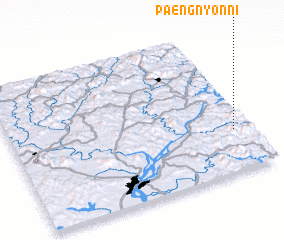 Places with similar names to Paengnyŏn-ni, Korea, North ::
// Paengnyŏn (KR)
// Pongnyŏn-ni (KP)
Disclaimer :: Information on this page comes without warranty of any kind |
||
|
Where is Paengnyŏn-ni? Elevation and coordinates ::
Latitude (lat): 40°17'48"N Longitude (lon): 124°56'2"E
Elevation (approx.): 174m (map arrows pan, magnifying glasses zoom) |
||
|
Visiting Paengnyŏn-ni? Hotel/Accommodation ::
Book a hotel in Paengnyŏn-ni Travel Guide ::
rental cars ::
car rental offers GPS waypoint ::
download a GPX waypoint (PoI) of Paengnyŏn-ni for your GPS receiver
|
||