|
search place name
|
||
Pop'a-ri (Yanggang, Korea, North)Pop'a-ri is a town in the Yanggang region of Korea, North. An overview map of the region around Pop'a-ri is displayed below.
regional and 3d topo map of Pop'a-ri, Korea, North ::
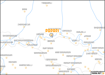
Nearby towns ::
Ibang-ni (2.2km south) //
Shisidaogou (2.3km north) //
P'ungyang-ni (2.2km west) //
Ch'oech'ŏl-li (2.4km north east) //
Tuji-ri (2.9km west) //
Chiŭng-ni (3.1km east) //
Komuso (3.3km west) //
Nŭptŏng-ni (4.9km south) //
Gangouzi (4.2km east) //
Sangdae-ri (4.5km east) //
Habyŏngp'ung-ni (6.8km south east) //
Samp'odong-ni (7.2km south west) //
Sinjung-ni (6.4km south west) //
Insal-li (6.6km east) //
Sonong-ni (6.6km west) //
Yŏngsŏng-ni (8.7km south) //
Nongp'yŏngha-ri (9.6km south east) //
[all distances 'as the bird flies' and approximate] 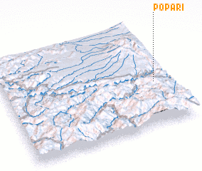 Places with similar names to Pop'a-ri, Korea, North ::
Disclaimer :: Information on this page comes without warranty of any kind |
||
|
Where is Pop'a-ri? Elevation and coordinates ::
Latitude (lat): 41°25'54"N Longitude (lon): 127°54'53"E
Elevation (approx.): 604m (map arrows pan, magnifying glasses zoom) |
||
|
Visiting Pop'a-ri? Hotel/Accommodation ::
Book a hotel in Pop'a-ri Travel Guide ::
rental cars ::
car rental offers GPS waypoint ::
download a GPX waypoint (PoI) of Pop'a-ri for your GPS receiver
|
||