|
search place name
|
||
P'osangdongsŏn-dong (Hamgyŏng, Korea, North)P'osangdongsŏn-dong is a town in the Hamgyŏng region of Korea, North. An overview map of the region around P'osangdongsŏn-dong is displayed below.
regional and 3d topo map of P'osangdongsŏn-dong, Korea, North ::

Nearby towns ::
Hongnidŏk (1.9km north) //
Sŏn-dong (2.0km south east) //
P'ojung-ni (2.4km south) //
Mae-dong (2.2km south west) //
Irŏn-gol (2.8km south) //
Komdŏk (3.7km south) //
Tŏk-tong (3.2km north west) //
Sanbong (3.9km north) //
Hadŏk-kol (3.8km north east) //
Wŏlli-dong (3.3km south east) //
Hansamgae (3.4km west) //
Wŏnsŏk-tong (4.6km south) //
Yŏngno-dong (3.8km south east) //
Son-gol (4.9km south west) //
Chŏl-gol (4.4km east) //
Nojŏk-tong (5.7km north east) //
Chulbau (4.9km north east) //
Hanwŏnch'i (4.8km south east) //
Koraedŭl (5.0km east) //
Naesandong-Sŏn-dong (6.1km north west) //
P'oha-ri (5.3km south east) //
P'ohang (5.4km south east) //
Kojin (5.7km south east) //
Chungp'yŏng-dong (5.7km north east) //
Naewŏn-gol (6.1km north west) //
Okt'aebong (5.4km west) //
Poch'ol-li (6.8km north east) //
Kajŏn (8.3km north) //
Andol-li (6.7km west) //
[all distances 'as the bird flies' and approximate] 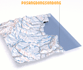 Places with similar names to P'osangdongsŏn-dong, Korea, North :: Disclaimer :: Information on this page comes without warranty of any kind |
||
|
Where is P'osangdongsŏn-dong? Elevation and coordinates ::
Latitude (lat): 41°1'0"N Longitude (lon): 129°39'50"E
Elevation (approx.): 178m (map arrows pan, magnifying glasses zoom) |
||
|
Visiting P'osangdongsŏn-dong? Hotel/Accommodation ::
Book a hotel in P'osangdongsŏn-dong Travel Guide ::
rental cars ::
car rental offers GPS waypoint ::
download a GPX waypoint (PoI) of P'osangdongsŏn-dong for your GPS receiver
|
||