|
search place name
|
||
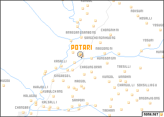
Pot'a-ri (Yanggang, Korea, North)Pot'a-ri is a town in the Yanggang region of Korea, North. An overview map of the region around Pot'a-ri is displayed below.
regional and 3d topo map of Pot'a-ri, Korea, North ::
Nearby towns ::
Konjangdŏk (0.6km north) //
Poch'ŏn-ŭp (1.6km south west) //
Ch'ukchŏl-li (1.6km east) //
Sanwi-ri (2.1km north west) //
Sujungdae (2.9km north east) //
Ŭihwa-ri (3.1km south west) //
Sindaesin (3.7km south) //
Chagŭn'goran (3.5km south east) //
Tokpong (3.6km south west) //
Ershisandaogou (4.5km north west) //
Araegangsanbong (4.9km north) //
Kasal-li (3.9km south west) //
Naegong-ni (4.0km east) //
Sinhŭng-ni (5.0km south east) //
Sangch'ŏngnim-dong (4.8km north east) //
Hŭngsŏng-ni (4.4km east) //
Mae-gol (6.4km south) //
Karim-ni (5.0km south west) //
Sin'gae-gol (6.0km south west) //
Ch'unhwa-dong (6.7km south) //
Op'ung-dong (6.9km south) //
Osal-li (6.9km south) //
Ŭihwa-ri (7.1km south) //
Ukkangsanbong (7.4km north) //
Chagŭnt'ongnam-dong (7.7km north) //
K'ŭn-gol (7.1km south east) //
Pokp'o-ri (7.1km south west) //
Kip'un'gae (8.4km north) //
Myŏnghwa-dong (6.4km east) //
[all distances 'as the bird flies' and approximate]  Places with similar names to Pot'a-ri, Korea, North ::
Disclaimer :: Information on this page comes without warranty of any kind |
||
|
Where is Pot'a-ri? Elevation and coordinates ::
Latitude (lat): 41°31'40"N Longitude (lon): 128°18'55"E
Elevation (approx.): 842m (map arrows pan, magnifying glasses zoom) |
||
|
Visiting Pot'a-ri? Hotel/Accommodation ::
Book a hotel in Pot'a-ri Travel Guide ::
rental cars ::
car rental offers GPS waypoint ::
download a GPX waypoint (PoI) of Pot'a-ri for your GPS receiver
|
||