|
search place name
|
||
P'ungso-ri (Korea, North)P'ungso-ri is a town in Korea, North. An overview map of the region around P'ungso-ri is displayed below.
regional and 3d topo map of P'ungso-ri, Korea, North ::

P'ungso-ri airports ::
The nearest airport is FNJ - Pyongyang Intl, located 71.8 km south east of P'ungso-ri.
Nearby towns ::
Sangch'ung (0.0km north) //
Oryu-dong (1.5km south) //
Hŭgu (1.5km north west) //
Tŏk-tong (1.9km north) //
Songjŏng (1.9km north) //
Kan-ni (1.4km east) //
Pongmyŏng-ni (1.4km west) //
Hach'ung (1.4km east) //
Wŏnbong-ni (1.4km east) //
Tongso-ri (1.4km east) //
Ŏhang (2.3km north east) //
Sŏguso-ri (2.3km north east) //
Yongp'o-ri (2.3km north east) //
Ch'ungdal (2.5km north west) //
Tongguso-ri (2.6km north east) //
Tapsang-ni (3.1km south) //
Mip'a-dong (2.9km north east) //
Saek-kol (3.0km south west) //
Pongmyŏngdong-Simwŏn (2.8km west) //
Naesan-ni (2.8km west) //
Tapha-ri (3.7km south) //
Sinjŏng-ni (2.9km east) //
Kongsim-dong (3.4km south east) //
Amdu-ri (3.4km south west) //
Yonggok (3.4km north west) //
Sigam (4.0km north) //
Ibam (4.0km north) //
Tokchang-dong (3.7km south east) //
Haengdam-ni (3.5km west) //
[all distances 'as the bird flies' and approximate] 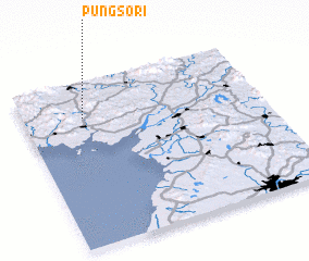 Places with similar names to P'ungso-ri, Korea, North ::
// Pengozero (RU)
// Pancasari (ID)
// Puncosora (PE)
// Pongsŏ-ri (KP)
// Pongsŏ-ri (KP)
// Pongsŏ-ri (KP)
// Pongsu-ri (KP)
// P'ungsŏ-ri (KP)
// P'ungsŏ-ri (KP)
// P'ungsŏ-ri (KP)
Disclaimer :: Information on this page comes without warranty of any kind |
||
|
Where is P'ungso-ri? Elevation and coordinates ::
Latitude (lat): 39°47'0"N Longitude (lon): 125°15'0"E
Elevation (approx.): 33m (map arrows pan, magnifying glasses zoom) |
||
|
Visiting P'ungso-ri? Hotel/Accommodation ::
Book a hotel in P'ungso-ri Travel Guide ::
rental cars ::
car rental offers GPS waypoint ::
download a GPX waypoint (PoI) of P'ungso-ri for your GPS receiver
|
||