|
search place name
|
||
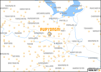
Pup'yŏng-ni (P'yŏngan, Korea, North)Pup'yŏng-ni is a town in the P'yŏngan region of Korea, North. An overview map of the region around Pup'yŏng-ni is displayed below.
regional and 3d topo map of Pup'yŏng-ni, Korea, North ::
Pup'yŏng-ni airports ::
The nearest airport is FNJ - Pyongyang Intl, located 81.3 km south of Pup'yŏng-ni.
Nearby towns ::
P'ungsŏng-ni (0.5km west) //
Kwangam-ni (0.9km north) //
Pokhyŏl-li (1.0km east) //
Ponghu-ri (1.8km north) //
Yongsang-ni (1.5km west) //
Yonghŭng-ni (2.2km south east) //
Yongsang-ni (1.9km west) //
Anhŭng-ni (2.4km east) //
Ant'ae-ri (2.4km east) //
Songt'ae-ri (2.5km east) //
Songch'ŏl-li (3.2km south) //
Sinbong-ni (3.1km south east) //
Pup'ung-ni (3.8km south) //
Songdŏng-ni (3.8km south) //
Ullyong-ni (3.9km south) //
Hŭngsal-li (3.9km south) //
Yongp'o-ri (3.1km east) //
Sinsang-ni (3.2km west) //
T'oeha-ri (3.6km north west) //
Songsang-ni (4.0km south) //
Sinp'yŏng-ni (3.3km west) //
Sinhŭng-ni (3.3km west) //
Sindŏng-ni (4.5km north) //
Taesal-li (4.2km south west) //
Pongsang-ni (3.8km south west) //
Map'yŏng-ni (4.3km north east) //
Ilbong-ni (4.5km south east) //
T'aech'ŏn-ŭp (3.9km east) //
Tangjŏ-ri (4.3km south east) //
[all distances 'as the bird flies' and approximate] 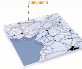 Places with similar names to Pup'yŏng-ni, Korea, North ::
// Pup'yŏng-ni (KP)
// Pup'yŏng-ni (KR)
// Pup'yŏng-ni (KP)
// Pup'yŏng-ni (KP)
// Pup'yŏng-ni (KP)
// Pup'yŏng-ni (KP)
Disclaimer :: Information on this page comes without warranty of any kind |
||
|
Where is Pup'yŏng-ni? Elevation and coordinates ::
Latitude (lat): 39°56'3"N Longitude (lon): 125°26'20"E
Elevation (approx.): 53m (map arrows pan, magnifying glasses zoom) |
||
|
Visiting Pup'yŏng-ni? Hotel/Accommodation ::
Book a hotel in Pup'yŏng-ni Travel Guide ::
rental cars ::
car rental offers GPS waypoint ::
download a GPX waypoint (PoI) of Pup'yŏng-ni for your GPS receiver
|
||