|
search place name
|
||
Sami (Korea, North)Sami is a town in Korea, North. An overview map of the region around Sami is displayed below.
regional and 3d topo map of Sami, Korea, North ::

Sami airports ::
The nearest airport is FNJ - Pyongyang Intl, located 67.5 km south east of Sami.
Nearby towns ::
Yŏnbong-ni (0.0km north) //
Chigyŏng (0.8km east) //
Ŭnch'ang-dong (1.6km south east) //
Yaksu-dong (2.3km north east) //
Kohyŏl-li (2.3km north west) //
Hadan (2.9km south) //
Songmang-dong (2.9km north) //
Yongdŏng-ni (2.7km south east) //
Kwangnim-dong (3.0km north east) //
Oryong-ni (2.8km east) //
Kongsim-dong (2.8km west) //
Sinjŏng-ni (3.1km north west) //
Su-dong (4.0km south) //
Chŏngp'o-dong (3.6km north west) //
Tokchang-dong (3.2km west) //
Kodŭn-gol (4.0km south east) //
Chu-gol (4.3km south) //
Il-li (3.8km south west) //
Sinal-li (3.9km south west) //
Sangdan (5.3km north) //
Ŏhang (5.5km south) //
Chwai-dong (5.6km north) //
Mip'a-dong (4.8km north west) //
Sangdan (4.7km south east) //
Ŏho-dong (4.9km south west) //
Hach'ung (4.7km north west) //
Kan-ni (4.7km north west) //
Tongso-ri (4.7km north west) //
Wŏnbong-ni (4.7km north west) //
[all distances 'as the bird flies' and approximate] 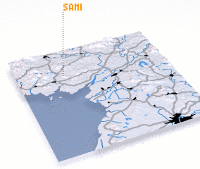 Places with similar names to Sami, Korea, North ::
Disclaimer :: Information on this page comes without warranty of any kind |
||
|
Where is Sami? Elevation and coordinates ::
Latitude (lat): 39°46'0"N Longitude (lon): 125°19'0"E
Elevation (approx.): 109m (map arrows pan, magnifying glasses zoom) |
||
|
Visiting Sami? Hotel/Accommodation ::
Book a hotel in Sami Travel Guide ::
rental cars ::
car rental offers GPS waypoint ::
download a GPX waypoint (PoI) of Sami for your GPS receiver
|
||