|
search place name
|
||
Samsan-dong (Hamgyŏng, Korea, North)Samsan-dong is a town in the Hamgyŏng region of Korea, North. An overview map of the region around Samsan-dong is displayed below.
regional and 3d topo map of Samsan-dong, Korea, North ::
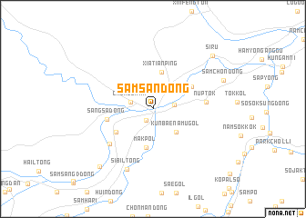
Nearby towns ::
Samjang-nodongjagu (1.5km south west) //
Imgang-ni (2.0km east) //
Chongshan (2.2km north west) //
K'ŭnbaenamu-gol (3.6km south east) //
Xiatianping (4.6km north) //
Makpŏl (4.8km south) //
Samjang-ni (4.4km south west) //
Araegubi (4.4km north east) //
Sangsa-dong (4.4km west) //
Nŭptŏk (5.0km east) //
Haryuk-tong (5.8km south west) //
Sibil-tong (7.8km south) //
Samch'ŏn-dong (7.4km north east) //
Sangnyuk-tong (8.6km south west) //
Siru (8.5km north east) //
[all distances 'as the bird flies' and approximate] 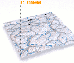 Places with similar names to Samsan-dong, Korea, North ::
// Samsan-dong (KP)
// Samsan-dong (KP)
// Samsan-dong (KP)
// Samsan-dong (KP)
// Simsan-dong (KP)
// Simsŏn-dong (KP)
// Samsan-dong (KR)
Disclaimer :: Information on this page comes without warranty of any kind |
||
|
Where is Samsan-dong? Elevation and coordinates ::
Latitude (lat): 42°5'33"N Longitude (lon): 129°0'27"E
Elevation (approx.): 614m (map arrows pan, magnifying glasses zoom) |
||
|
Visiting Samsan-dong? Hotel/Accommodation ::
Book a hotel in Samsan-dong Travel Guide ::
rental cars ::
car rental offers GPS waypoint ::
download a GPX waypoint (PoI) of Samsan-dong for your GPS receiver
|
||