|
search place name
|
||
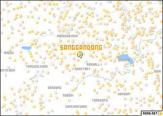
Sanggan-dong (Hwanghae, Korea, North)Sanggan-dong is a town in the Hwanghae region of Korea, North. An overview map of the region around Sanggan-dong is displayed below.
regional and 3d topo map of Sanggan-dong, Korea, North ::
Sanggan-dong airports ::
The nearest airport is FNJ - Pyongyang Intl, located 103.6 km north of Sanggan-dong.
Other airports nearby include GMP - Seoul Gimpo (138.1 km south east), SSN - Seoul East Seoul Ab (168.6 km south east), OSN - Osan Ab (188.4 km south east), Nearby towns ::
Chibang-dong (0.9km south west) //
Sagyŏl-li (1.0km north) //
Chegung-dong (1.2km south east) //
Wŏlsŏng-ni (1.5km north west) //
Sŏngje-dong (1.4km west) //
Sangnae-dong (1.8km north west) //
Yamyŏng-dong (1.7km east) //
Puam (2.1km north) //
Pun-dong (2.1km south west) //
Ch'ang-ch'on (2.0km east) //
Toksŏng-dong (2.4km north east) //
Charahyŏn (2.5km north east) //
Powŏl-tong (2.3km north west) //
Chungsin (2.7km north west) //
Hyu-dong (2.8km south west) //
Pun-dong (2.6km north east) //
Chuksan-dong (3.1km north) //
T'ŏ-gol (2.9km north east) //
Wach'ŏn-dong (2.7km east) //
Changnim-dong (3.4km north) //
Pangjae-dong (2.9km south west) //
Mok-kol (3.0km north east) //
Yongjŏng-ni (3.3km north west) //
Yangji-dong (3.3km north east) //
Maebong-gol (3.2km north east) //
Chihyŏn-dong (3.5km south) //
Palsal-li (3.5km north) //
Sŏkkyo-ri (3.7km south) //
Hanjŏng-ni (3.7km north) //
[all distances 'as the bird flies' and approximate]  Places with similar names to Sanggan-dong, Korea, North ::
// Singondaing (MM)
// Singondaing (MM)
// Sangan-dong (KP)
// Sanggan-dong (KP)
// Sanggon-dong (KP)
// Sangnae-dong (KP)
// Sangnae-dong (KP)
// Sangnu-dong (KP)
// Sangŭn-dong (KP)
// Sangŭn-dong (KP)
Disclaimer :: Information on this page comes without warranty of any kind |
||
|
Where is Sanggan-dong? Elevation and coordinates ::
Latitude (lat): 38°17'52"N Longitude (lon): 125°31'38"E
Elevation (approx.): 64m (map arrows pan, magnifying glasses zoom) |
||
|
Visiting Sanggan-dong? Hotel/Accommodation ::
Book a hotel in Sanggan-dong Travel Guide ::
rental cars ::
car rental offers GPS waypoint ::
download a GPX waypoint (PoI) of Sanggan-dong for your GPS receiver
|
||