|
search place name
|
||
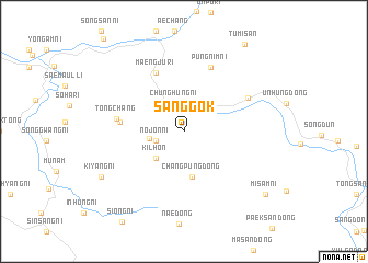
Sanggok (P'yŏngan, Korea, North)Sanggok is a town in the P'yŏngan region of Korea, North. An overview map of the region around Sanggok is displayed below.
regional and 3d topo map of Sanggok, Korea, North ::
Sanggok airports ::
The nearest airport is FNJ - Pyongyang Intl, located 94.8 km south west of Sanggok.
Other airports nearby include SHO - Sokch'o Sokcho (236.4 km south east), Nearby towns ::
Nojŏn-ni (2.4km west) //
Chunghŭng-ni (2.9km north) //
Mokchang-ni (2.8km west) //
Kilhŏn (3.5km south west) //
Changp'ung-dong (4.7km south) //
Pangmong-ni (4.7km south) //
Taehŭng-ni (5.1km west) //
Maengju-ri (6.4km north) //
Tongch'ang (5.4km west) //
P'ungnim-ni (6.8km north) //
Subang-dong (6.1km north east) //
Kiyang-ni (7.9km south west) //
Misam-ni (9.1km south east) //
Tumisan (10.1km north east) //
[all distances 'as the bird flies' and approximate] 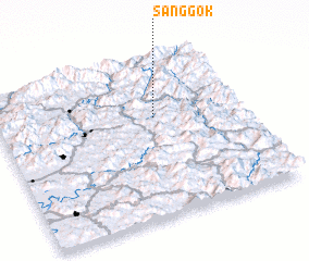 Places with similar names to Sanggok, Korea, North ::
Disclaimer :: Information on this page comes without warranty of any kind |
||
|
Where is Sanggok? Elevation and coordinates ::
Latitude (lat): 39°37'29"N Longitude (lon): 126°38'32"E
Elevation (approx.): 351m (map arrows pan, magnifying glasses zoom) |
||
|
Visiting Sanggok? Hotel/Accommodation ::
Book a hotel in Sanggok Travel Guide ::
rental cars ::
car rental offers GPS waypoint ::
download a GPX waypoint (PoI) of Sanggok for your GPS receiver
|
||