|
search place name
|
||
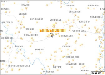
Sangsadon-ni (Kangwŏn, Korea, North)Sangsadon-ni is a town in the Kangwŏn region of Korea, North. An overview map of the region around Sangsadon-ni is displayed below.
regional and 3d topo map of Sangsadon-ni, Korea, North ::
Sangsadon-ni airports ::
The nearest airport is SHO - Sokch'o Sokcho, located 85.3 km south east of Sangsadon-ni.
Other airports nearby include KAG - Kangnung Gangneung (136.4 km south east), SSN - Seoul East Seoul Ab (142.4 km south west), GMP - Seoul Gimpo (146.7 km south west), OSN - Osan Ab (181.4 km south west), Nearby towns ::
Sangyangji (1.0km west) //
Hoedong-ni (1.2km north west) //
K'ŭn-gol (1.6km north east) //
Hakumal-li (1.9km north) //
Sadong-ni (1.6km north west) //
Kŭmsal-li (2.1km north) //
Soksadong-ni (2.0km north east) //
Chagŭn-gol (2.0km east) //
Mŏngemal (2.8km north) //
Kanchŏmbang-ni (3.7km north) //
Koksal-li (3.8km north) //
Kŭmgong-ni (4.0km north) //
Sangguman-ni (3.8km north) //
Sadong-ni (4.4km north) //
Sanwŏl-li (4.4km north) //
P'yŏngji-dong (4.6km south east) //
Tangp'yŏng-ni (5.1km south) //
Tangdunji (5.1km south) //
Sambau-gol (5.3km north) //
Kanbalgo-ri (4.3km east) //
Ungnim-dong (4.6km south east) //
Samdae-ri (4.5km south east) //
Tangsal-li (5.4km south east) //
Kasin-dong (6.3km south) //
Sangjŏmbang-ni (6.2km north east) //
Ch'ŏngjŏng-ni (5.5km north east) //
Hwajŏn-dong (6.8km south) //
Sinsŏng-ni (6.3km south west) //
Kŏn'gi-gol (6.0km south east) //
[all distances 'as the bird flies' and approximate]  Places with similar names to Sangsadon-ni, Korea, North ::
// San Agustin (US)
// San Augustine (US)
// San Agustín (PA)
// San Agustín (PA)
// San Agustín (CU)
// San Agustín (CU)
// San Agustín (CU)
// San Agustín (CU)
// San Agustín (CU)
// San Agustín (CU)
Disclaimer :: Information on this page comes without warranty of any kind |
||
|
Where is Sangsadon-ni? Elevation and coordinates ::
Latitude (lat): 38°36'6"N Longitude (lon): 127°48'59"E
Elevation (approx.): 518m (map arrows pan, magnifying glasses zoom) |
||
|
Visiting Sangsadon-ni? Hotel/Accommodation ::
Book a hotel in Sangsadon-ni Travel Guide ::
rental cars ::
car rental offers GPS waypoint ::
download a GPX waypoint (PoI) of Sangsadon-ni for your GPS receiver
|
||