|
search place name
|
||
Se-dong (Korea, North)Se-dong is a town in Korea, North. An overview map of the region around Se-dong is displayed below.
regional and 3d topo map of Se-dong, Korea, North ::

Se-dong airports ::
The nearest airport is FNJ - Pyongyang Intl, located 91.2 km south east of Se-dong.
Nearby towns ::
Yulmok-tong (0.9km south west) //
Songhyŏn-ni (1.5km south east) //
Ch'ungsin-dong (1.4km west) //
Yongsan-dong (1.9km north) //
Sŏlmae-dong (2.3km south west) //
Chindo-ri (2.3km north east) //
Sŏ-gol (2.3km south east) //
Chigyŏng-ni (2.3km south east) //
Kamch'am (2.9km north) //
Sujin-gol (3.5km south) //
Samma-gol (3.7km south) //
Songga-gol (3.7km south) //
Ilbongdong-Tae-dong (3.7km south) //
Ch'ŏngnyong-ni (3.2km north east) //
Ilbong-ni (3.7km south) //
Yangji-dong (3.1km west) //
Hapchŏng (4.0km north) //
Tohwa-gol (3.4km south west) //
Samhoe-dong (4.0km south) //
Yangji-gol (4.4km south) //
Tangsan-dong (4.6km south) //
Changyo-ri (4.1km south east) //
Kama-gol (4.7km south west) //
Songjŏng (5.6km north) //
Sinsŏng-ni (4.3km west) //
Sangdan (5.7km north) //
Urari-maŭl (5.7km south) //
Toam-gol (5.7km south) //
Songhyŏl-li (5.7km south) //
[all distances 'as the bird flies' and approximate] 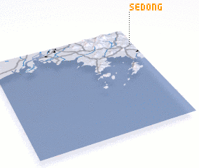 Places with similar names to Se-dong, Korea, North ::
Disclaimer :: Information on this page comes without warranty of any kind |
||
|
Where is Se-dong? Elevation and coordinates ::
Latitude (lat): 39°51'0"N Longitude (lon): 124°59'0"E
Elevation (approx.): 176m (map arrows pan, magnifying glasses zoom) |
||
|
Visiting Se-dong? Hotel/Accommodation ::
Book a hotel in Se-dong Travel Guide ::
rental cars ::
car rental offers GPS waypoint ::
download a GPX waypoint (PoI) of Se-dong for your GPS receiver
|
||