|
search place name
|
||
Simnijŏng (Hamgyŏng, Korea, North)Simnijŏng is a town in the Hamgyŏng region of Korea, North. An overview map of the region around Simnijŏng is displayed below.
regional and 3d topo map of Simnijŏng, Korea, North ::
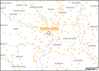
Nearby towns ::
Chunam-ni (0.6km north) //
Tong-ch'on (0.7km north) //
Paegwŏl-li (0.6km east) //
Sang-ch'on (0.8km east) //
Paegwŏndongsang-ch'on (0.9km south west) //
Nam-ch'on (1.2km north west) //
Chung-ch'on (1.4km north west) //
Hakp'o (1.6km south east) //
Ip'o (1.8km south east) //
Nae-ch'on (1.6km north west) //
Paegwŏndongmal-ch'on (2.1km south) //
Tong-ch'on (2.1km south) //
Subyŏn-ch'on (2.5km north) //
T'abyang-ni (2.6km south) //
Haengnang-ch'on (2.4km north east) //
Yŏnggi-dong (2.8km north east) //
Sang-ch'on (3.1km south) //
Chunam-nodongjagu (2.7km north west) //
Sint'aptongnamsŏk-ch'on (3.2km south) //
Ssangnyong-ni (2.5km east) //
Tong-ch'on (2.6km east) //
Nam-ch'on (2.8km south east) //
Chugan-ch'on (3.5km south) //
Namp'yŏng-ch'on (3.3km north east) //
Chung-ch'on (3.7km south) //
Kilchu-ŭp (3.7km north) //
Ha-ch'on (3.0km north west) //
Hŭngun-dong (3.0km south east) //
Sŏ-ch'on (3.0km south east) //
[all distances 'as the bird flies' and approximate] 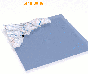 Places with similar names to Simnijŏng, Korea, North ::
// Simnijŏng (KP)
Disclaimer :: Information on this page comes without warranty of any kind |
||
|
Where is Simnijŏng? Elevation and coordinates ::
Latitude (lat): 40°55'40"N Longitude (lon): 129°19'2"E
Elevation (approx.): 101m (map arrows pan, magnifying glasses zoom) |
||
|
Visiting Simnijŏng? Hotel/Accommodation ::
Book a hotel in Simnijŏng Travel Guide ::
rental cars ::
car rental offers GPS waypoint ::
download a GPX waypoint (PoI) of Simnijŏng for your GPS receiver
|
||