|
search place name
|
||
Sindang-dong (Hamgyŏng, Korea, North)Sindang-dong is a town in the Hamgyŏng region of Korea, North. An overview map of the region around Sindang-dong is displayed below.
regional and 3d topo map of Sindang-dong, Korea, North ::

Nearby towns ::
Chudŏkp'o (1.3km south west) //
P'allyongdŏgi (1.9km north) //
Tongp'a (1.9km west) //
Pŏppat-kol (2.8km south) //
Taegaek-ch'on (2.3km east) //
Sasŭmk'o-mal (3.0km north) //
Sinch'ang-dong (2.7km south east) //
Yŏjindŏgi (3.2km south east) //
Hwangch'ŏl-gol (3.3km north) //
Sindŏng-ni (3.1km south west) //
Noha-ch'on (3.5km south) //
Chich'odŏgi (3.3km south west) //
Hŭktari (3.6km north) //
Sŏ-ch'on (3.7km south) //
Sae-mal (3.8km north) //
Tokchang-gol (3.8km north) //
Malgŭndam (4.0km south) //
Tong-ch'on (3.9km south east) //
Chungp'yŏng (3.3km west) //
Pidŭkpau-gol (4.6km north) //
Wŏlsandŏgi (3.6km east) //
Hongsu-dong (3.7km west) //
Chagŭntalmedŏgi (3.8km east) //
Ha-ch'on (4.7km south east) //
Kuryongso (5.2km north west) //
Chungdŏgi (4.9km south east) //
Kusŏktŏgi (5.6km north) //
Namjŏlsu (5.5km north) //
Obongdŏgi (6.0km north) //
[all distances 'as the bird flies' and approximate] 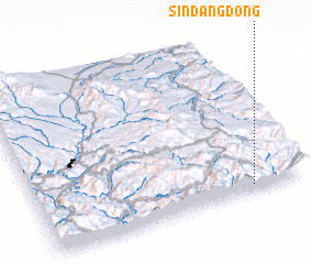 Places with similar names to Sindang-dong, Korea, North ::
// Sindaung Taung (MM)
// Sindanga-dong (KP)
// Sindong-dong (KP)
// Sindang-dong (KR)
// Sŏndang-dong (KR)
Disclaimer :: Information on this page comes without warranty of any kind |
||
|
Where is Sindang-dong? Elevation and coordinates ::
Latitude (lat): 41°2'42"N Longitude (lon): 128°48'3"E
Elevation (approx.): 1140m (map arrows pan, magnifying glasses zoom) |
||
|
Visiting Sindang-dong? Hotel/Accommodation ::
Book a hotel in Sindang-dong Travel Guide ::
rental cars ::
car rental offers GPS waypoint ::
download a GPX waypoint (PoI) of Sindang-dong for your GPS receiver
|
||