|
search place name
|
||
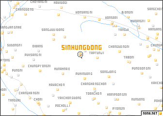
Sinhŭng-dong (Hamgyŏng, Korea, North)Sinhŭng-dong is a town in the Hamgyŏng region of Korea, North. An overview map of the region around Sinhŭng-dong is displayed below.
regional and 3d topo map of Sinhŭng-dong, Korea, North ::
Nearby towns ::
Sa-dong (1.8km north) //
T'aptunji (2.8km east) //
Pumin-dong (4.8km south) //
Munamnae (4.9km south west) //
Sangjuŭi-dong (5.6km north west) //
Changhang-ch'on (7.4km south) //
Songjong (6.5km south east) //
Pakchŏn-dong (6.5km north west) //
Such'im-dong (7.9km south) //
Sangjuŭi-dong (7.3km north west) //
Changdong-ni (6.8km east) //
Mawa-ch'on (8.5km south west) //
Ch'oe-ch'on (8.2km south east) //
Sang-ch'on (8.0km north east) //
Wŏnjŏl-li (9.4km north) //
Ko-ch'on (9.3km north east) //
Wŏndong-ni (9.5km north east) //
Wŏnsa-ri (9.8km north east) //
Sodunji (9.6km north east) //
Sinsang-ni (10.0km south west) //
[all distances 'as the bird flies' and approximate]  Places with similar names to Sinhŭng-dong, Korea, North ::
// Sinhŭng-dong (KP)
// Sinhŭng-dong (KP)
// Sinhŭng-dong (KP)
// Sinhŭng-dong (KP)
// Sinhŭng-dong (KP)
// Sinhŭng-dong (KP)
// Sinhŭng-dong (KP)
// Sinhŭng-dong (KP)
// Sinhŭng-dong (KP)
// Sinhŭng-dong (KP)
Disclaimer :: Information on this page comes without warranty of any kind |
||
|
Where is Sinhŭng-dong? Elevation and coordinates ::
Latitude (lat): 40°17'45"N Longitude (lon): 128°26'15"E
Elevation (approx.): 461m (map arrows pan, magnifying glasses zoom) |
||
|
Visiting Sinhŭng-dong? Hotel/Accommodation ::
Book a hotel in Sinhŭng-dong Travel Guide ::
rental cars ::
car rental offers GPS waypoint ::
download a GPX waypoint (PoI) of Sinhŭng-dong for your GPS receiver
|
||