|
search place name
|
||
Songam-ni (Yanggang, Korea, North)Songam-ni is a town in the Yanggang region of Korea, North. An overview map of the region around Songam-ni is displayed below.
regional and 3d topo map of Songam-ni, Korea, North ::
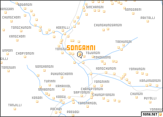
Nearby towns ::
Toha-ri (0.6km north east) //
Koam-ni (1.1km south) //
Sanghŭng-ni (1.6km south west) //
Songgye-ri (1.7km north west) //
Tojung-ni (2.1km east) //
Hwajang-ni (2.2km north west) //
Yŏnp'ung-ni (3.8km north) //
Kapsan-ŭp (4.0km south east) //
Taep'yŏng-ni (4.3km north) //
Yongsu-ri (3.5km west) //
Taejung-ni (4.4km north west) //
Tohoe-dong (3.7km east) //
Sedong-ni (4.2km east) //
Hwajang-ni (5.5km north west) //
Usang-ni (4.7km north west) //
Uha-ri (5.1km north west) //
Taep'yŏng-ni (5.4km north west) //
Puhŭngch'on-ni (5.5km south west) //
Mongch'ung-ni (5.3km south east) //
Kyohang-ni (6.3km north west) //
Sadonggu-ri (6.7km south) //
Hap'ohang-ni (7.3km north) //
Ch'ŏngjip'yŏng (5.6km east) //
Hoeril-li (7.1km north west) //
Yongnim-ni (7.1km south east) //
Huji-ri (6.8km north west) //
Chungp'ohang-ni (8.1km north) //
Ch'angsong-ni (6.2km east) //
Chunghŭngha-ri (7.5km north east) //
[all distances 'as the bird flies' and approximate] 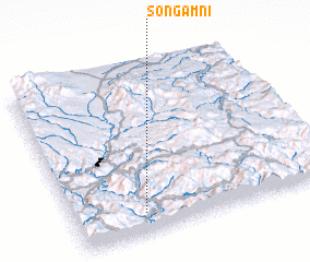 Places with similar names to Songam-ni, Korea, North ::
// Sangamon (US)
// Ciénaga Mono (PA)
// Sung Men (TH)
// Zinkumbini (ZA)
// Sungaiman (ID)
// Sungaimanau (ID)
// Sungaimanau (ID)
// Sunggumanai (ID)
// Sāng Miāni (PK)
// Sankaman (GN)
Disclaimer :: Information on this page comes without warranty of any kind |
||
|
Where is Songam-ni? Elevation and coordinates ::
Latitude (lat): 41°7'21"N Longitude (lon): 128°16'23"E
Elevation (approx.): 810m (map arrows pan, magnifying glasses zoom) |
||
|
Visiting Songam-ni? Hotel/Accommodation ::
Book a hotel in Songam-ni Travel Guide ::
rental cars ::
car rental offers GPS waypoint ::
download a GPX waypoint (PoI) of Songam-ni for your GPS receiver
|
||