|
search place name
|
||
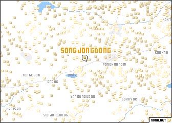
Songjŏng-dong (Hwanghae, Korea, North)Songjŏng-dong is a town in the Hwanghae region of Korea, North. An overview map of the region around Songjŏng-dong is displayed below.
regional and 3d topo map of Songjŏng-dong, Korea, North ::
Songjŏng-dong airports ::
The nearest airport is FNJ - Pyongyang Intl, located 99.4 km north of Songjŏng-dong.
Other airports nearby include GMP - Seoul Gimpo (147.2 km south east), SSN - Seoul East Seoul Ab (177.7 km south east), OSN - Osan Ab (197.5 km south east), Nearby towns ::
Panjŏng-ni (0.4km north east) //
Yŏn-dong (0.8km north east) //
Chungban-dong (0.8km north west) //
Kansu-dong (0.8km west) //
Kwangch'on (1.6km south west) //
Hŏsan-dong (1.6km south west) //
Songnim-dong (1.8km south west) //
Sangban-dong (1.7km north west) //
Yuja-dong (2.0km south west) //
Kaejŏng-dong (2.2km south) //
Yangjŏng-dong (1.9km north east) //
Chŏnsan-dong (2.3km south west) //
Changsŏn-dong (2.0km east) //
Samhwang-ni (2.6km south) //
Tohwa-dong (2.2km west) //
Pogu-ri (2.6km south west) //
Kwanggan-dong (2.9km north) //
Mangil-gol (2.9km south) //
Koga-dong (2.9km south east) //
Tugwang-dong (2.9km south west) //
Pungmangil (3.2km south east) //
Kajwa-dong (3.1km south east) //
Oema-dong (3.4km north east) //
Naema-dong (3.6km north) //
Magŭndegi (3.8km north) //
Chŏksu-dong (3.4km south east) //
Nammangil (3.9km south) //
Unnŭng-gol (3.5km north west) //
Pakkakkalgae (3.4km west) //
[all distances 'as the bird flies' and approximate]  Places with similar names to Songjŏng-dong, Korea, North ::
// Sangjang-dong (KP)
// Sangjang-dong (KP)
// Sangjang-dong (KP)
// Sangjang-dong (KP)
// Sangjŏng-dong (KP)
// Sangjŭng-dong (KP)
// Sangjung-dong (KP)
// Sŏngjang-dong (KP)
// Songjŏng-dong (KP)
// Songjŏng-dong (KP)
Disclaimer :: Information on this page comes without warranty of any kind |
||
|
Where is Songjŏng-dong? Elevation and coordinates ::
Latitude (lat): 38°20'46"N Longitude (lon): 125°26'34"E
Elevation (approx.): 37m (map arrows pan, magnifying glasses zoom) |
||
|
Visiting Songjŏng-dong? Hotel/Accommodation ::
Book a hotel in Songjŏng-dong Travel Guide ::
rental cars ::
car rental offers GPS waypoint ::
download a GPX waypoint (PoI) of Songjŏng-dong for your GPS receiver
|
||