|
search place name
|
||
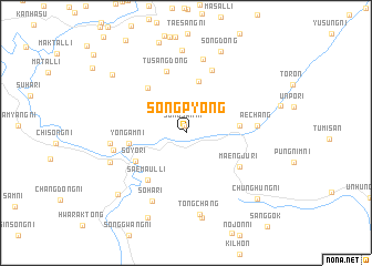
Songp'yŏng (P'yŏngan, Korea, North)Songp'yŏng is a town in the P'yŏngan region of Korea, North. An overview map of the region around Songp'yŏng is displayed below.
regional and 3d topo map of Songp'yŏng, Korea, North ::
Songp'yŏng airports ::
The nearest airport is FNJ - Pyongyang Intl, located 94.2 km south west of Songp'yŏng.
Nearby towns ::
Songsan-ni (0.8km north) //
Sinhŭng (5.3km north) //
Kwanghwa-ri (4.2km east) //
Soyo-ri (4.8km south west) //
Pallyong-dong (4.6km west) //
Yongam-ni (4.6km west) //
Ch'unggudŏk (5.4km north west) //
Saemaŭl-li (5.6km south west) //
Maengju-ri (5.4km south east) //
Tusang-dong (6.4km north) //
Chunghŭng-dong (6.6km north) //
Aech'ang (5.6km east) //
Inp'o-nodongjagu (5.9km west) //
Soha-ri (7.3km south) //
Pae-gol (7.6km north) //
Sinhŭng-ni (5.9km west) //
Hyo-ri (5.9km west) //
Sohak-tong (6.5km south west) //
Kiŭn-dong (8.3km north) //
Tongch'ang (8.3km south) //
Taehŭng-ni (8.6km south) //
Song-dong (8.6km north) //
Maengsan-ŭp (8.2km south west) //
P'yŏngji-ri (9.0km south) //
Yŏngyŏl-li (8.2km north west) //
Chunghŭng-ni (8.7km south east) //
[all distances 'as the bird flies' and approximate] 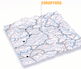 Places with similar names to Songp'yŏng, Korea, North ::
// Sangp'yŏng (KP)
// Sangp'yŏng (KP)
// Sangp'yŏng (KP)
// Sangp'yŏng (KP)
// Sangp'yŏng (KP)
// Songp'yŏng (KP)
// Sangp'yŏng (KR)
// Sangp'yŏng (KR)
// Sangp'yŏng (KR)
// Sangp'yŏng (KR)
Disclaimer :: Information on this page comes without warranty of any kind |
||
|
Where is Songp'yŏng? Elevation and coordinates ::
Latitude (lat): 39°42'35"N Longitude (lon): 126°34'6"E
Elevation (approx.): 212m (map arrows pan, magnifying glasses zoom) |
||
|
Visiting Songp'yŏng? Hotel/Accommodation ::
Book a hotel in Songp'yŏng Travel Guide ::
rental cars ::
car rental offers GPS waypoint ::
download a GPX waypoint (PoI) of Songp'yŏng for your GPS receiver
|
||