|
search place name
|
||
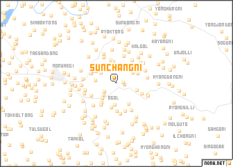
Sunch'ang-ni (P'yŏngyang, Korea, North)Sunch'ang-ni is a town in the P'yŏngyang region of Korea, North. An overview map of the region around Sunch'ang-ni is displayed below.
regional and 3d topo map of Sunch'ang-ni, Korea, North ::
Sunch'ang-ni airports ::
The nearest airport is FNJ - Pyongyang Intl, located 46.1 km west of Sunch'ang-ni.
Other airports nearby include GMP - Seoul Gimpo (182.6 km south), SSN - Seoul East Seoul Ab (204.1 km south east), Nearby towns ::
Chingye-dong (0.8km north) //
Ch'angŭi-ri (0.9km east) //
Chikch'ang (1.0km east) //
Yangji (2.0km south west) //
Sesim-ni (2.5km south west) //
Sansu-dong (2.9km north east) //
Kach'a-dong (2.6km north west) //
Munch'ang-ni (2.7km north east) //
Koemi-dong (3.0km south west) //
Maeŭm (2.7km west) //
Chŏl-gol (2.7km south east) //
O-gol (3.4km south) //
Sa-dong (3.6km north) //
Chae-gol (3.1km north east) //
Munan (3.2km north west) //
Yŏnja-gol (3.6km south east) //
Pam-gol (3.8km north) //
Hwagang-ni (3.6km south west) //
Saebangsŏng (3.9km south) //
Posŏng (3.6km north west) //
Songjae (3.9km south west) //
Sang-ni (3.6km north west) //
P'yŏng-ch'on (3.5km south east) //
Piryugang-nodongjagu (3.6km north west) //
Pongori (4.4km south) //
Saem-gol (4.2km north east) //
Ŏn-dong (3.7km south west) //
Kŭnŭl-li (4.5km north) //
Kŏnnŏ-gol (4.6km south) //
[all distances 'as the bird flies' and approximate]  Places with similar names to Sunch'ang-ni, Korea, North ::
// Sinch'ang-ni (KP)
// Sinch'ang-ni (KP)
// Sinch'ang-ni (KP)
// Sinch'ang-ni (KP)
// Sinch'ŏng-ni (KP)
// Sinch'ŏng-ni (KP)
// Sinch'ang-ni (KR)
// Sinch'ang-ni (KR)
// Sinch'ung-ni (KR)
// Sŏnch'ang-ni (KR)
Disclaimer :: Information on this page comes without warranty of any kind |
||
|
Where is Sunch'ang-ni? Elevation and coordinates ::
Latitude (lat): 39°8'4"N Longitude (lon): 126°11'26"E
Elevation (approx.): 86m (map arrows pan, magnifying glasses zoom) |
||
|
Visiting Sunch'ang-ni? Hotel/Accommodation ::
Book a hotel in Sunch'ang-ni Travel Guide ::
rental cars ::
car rental offers GPS waypoint ::
download a GPX waypoint (PoI) of Sunch'ang-ni for your GPS receiver
|
||