|
search place name
|
||
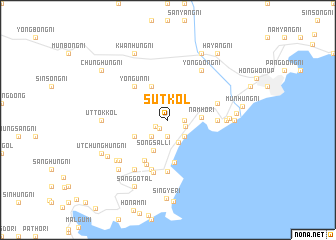
Sut-kol (Korea, North)Sut-kol is a town in Korea, North. An overview map of the region around Sut-kol is displayed below.
regional and 3d topo map of Sut-kol, Korea, North ::
Sut-kol airports ::
The nearest airport is SHO - Sokch'o Sokcho, located 213.9 km south of Sut-kol.
Nearby towns ::
Yŏm-ni (1.2km south west) //
Sinp'ung-ni (1.3km south west) //
P'ungnam-ni (1.9km south) //
Songho-ri (1.4km east) //
Songhae-ri (1.6km south east) //
Songp'yŏng-ni (2.3km south east) //
Yonghŭng-ni (2.3km south west) //
Sangbu-ri (2.3km south west) //
P'ungsŏ-ri (2.3km south west) //
Songhŭng-ni (2.6km south) //
Namho-ri (2.9km east) //
Songsal-li (3.6km south) //
Wangŭng-gol (3.4km south west) //
Unhŭng-ni (4.0km north) //
Samho-rodongjagu (4.8km south) //
Yongun-ni (4.7km north west) //
Ŭndong-ni (5.0km south west) //
Sangsong-ni (5.3km south) //
Yŏndong-ni (4.3km east) //
Yongyŏn-ni (5.8km south) //
Nach'ŏl-li (5.7km south) //
Wŏnho-ri (4.6km north east) //
Ch'ŏnjung-ni (6.0km south) //
Haeam-ni (5.0km east) //
Ch'ŏngsu-ri (6.2km north east) //
Yongdong-ni (6.2km north east) //
Nasang-ni (6.2km south west) //
Honam-ni (5.3km east) //
Sangp'yŏng-ni (6.2km south west) //
[all distances 'as the bird flies' and approximate] 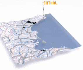 Places with similar names to Sut-kol, Korea, North ::
Disclaimer :: Information on this page comes without warranty of any kind |
||
|
Where is Sut-kol? Elevation and coordinates ::
Latitude (lat): 39°59'0"N Longitude (lon): 127°52'0"E
Elevation (approx.): 69m (map arrows pan, magnifying glasses zoom) |
||
|
Visiting Sut-kol? Hotel/Accommodation ::
Book a hotel in Sut-kol Travel Guide ::
rental cars ::
car rental offers GPS waypoint ::
download a GPX waypoint (PoI) of Sut-kol for your GPS receiver
|
||