|
search place name
|
||
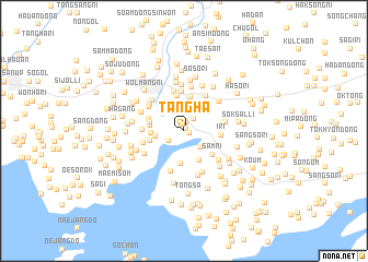
Tangha (P'yŏngan, Korea, North)Tangha is a town in the P'yŏngan region of Korea, North. An overview map of the region around Tangha is displayed below.
regional and 3d topo map of Tangha, Korea, North ::
Tangha airports ::
The nearest airport is FNJ - Pyongyang Intl, located 59.0 km south east of Tangha.
Nearby towns ::
Ch'imhyang-ni (0.3km north east) //
Kosŏng (0.5km south east) //
Un-dong (0.7km north) //
Namso-ri (0.9km north) //
Kŭnmal (1.5km north east) //
Palsan (1.6km north) //
Tongnaeso-ri (1.5km south west) //
Taesal-li (2.2km south east) //
Taesŏng-dong (2.8km north) //
P'uho (2.3km west) //
Sangwŏl (2.7km north west) //
Namyang-ni (2.6km west) //
Ch'angbuk (3.4km south) //
Sinch'ang-gol (3.3km south) //
Oedo-ri (2.7km west) //
Noso-ri (3.2km north east) //
Taesori (3.5km north) //
Tŏgyang (2.8km west) //
Namyangdong-An-gol (2.8km west) //
Yangji-ri (3.6km north) //
Sam-ni (3.3km south east) //
Hawŏl (3.0km north west) //
I-ri (3.0km east) //
Sangso-ri (4.0km north) //
Tongmal-li (4.1km north) //
Tongso-ri (4.0km north east) //
Yŏng-dong (3.3km west) //
Chin'gang (3.6km north west) //
Sŏksanso-ri (3.4km east) //
[all distances 'as the bird flies' and approximate] 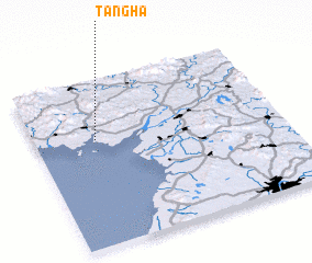 Places with similar names to Tangha, Korea, North ::
Disclaimer :: Information on this page comes without warranty of any kind |
||
|
Where is Tangha? Elevation and coordinates ::
Latitude (lat): 39°38'31"N Longitude (lon): 125°14'51"E
Elevation (approx.): 14m (map arrows pan, magnifying glasses zoom) |
||
|
Visiting Tangha? Hotel/Accommodation ::
Book a hotel in Tangha Travel Guide ::
rental cars ::
car rental offers GPS waypoint ::
download a GPX waypoint (PoI) of Tangha for your GPS receiver
|
||